Paper I — Q8
(a) What are landslides and avalanches? Discuss the causes and effects of landslides. Enumerate the remedial measures to prevent…
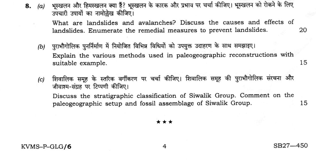
What are landslides and avalanches? Discuss the causes and effects of landslides. Enumerate the remedial measures to prevent landslides. 20 marks
Explain the various methods used in paleogeographic reconstructions with suitable example. 15 marks
Discuss the stratigraphic classification of Siwalik Group. Comment on the paleogeographic setup and fossil assemblage of Siwalik Group. 15 marks
हिंदी में प्रश्न पढ़ें
भूस्खलन और हिमस्खलन क्या हैं? भूस्खलन के कारक और प्रभाव पर चर्चा कीजिए। भूस्खलन को रोकने के लिए उपचारी उपायों का नामोल्लेख कीजिए। (20 अंक)
पुराभौगोलिक पुनर्निर्माण में नियोजित विभिन्न विधियों को उपयुक्त उदाहरण के साथ समझाइए। (15 अंक)
शिवालिक समूह के स्तरिक वर्गीकरण पर चर्चा कीजिए। शिवालिक समूह की पुराभौगोलिक संरचना और जीवाश्म-संग्रह पर टिप्पणी कीजिए। (15 अंक)
Model answer
Drafted with AI by UPSC Answer Check against this question's marking rubric, to the expected length. UPSC does not publish answers for Mains — this is one way to score well, not an official key. How we build rubrics and answers.
(a) Landslides and avalanches: causes, effects and remedial measures (20 marks)
Definitions. A landslide is the downslope movement of rock, debris or earth under gravity, as falls, slides, flows or topples. An avalanche is the rapid flow of a mass of snow and ice, often with rock debris, down a mountain slope.
Causes.
- Natural: steep slopes; weak, weathered or clay-rich rocks; unfavourable structure, with bedding, joints or faults dipping out of the slope; heavy rainfall and snowmelt, which raise pore pressure and reduce shear strength; earthquakes and volcanic activity; undercutting by rivers or the sea; freeze–thaw.
- Human: road and railway cuts, quarrying and blasting, deforestation, overloading of slopes, leaking irrigation and poor drainage.
Effects. The effects are loss of life, houses, roads, railways and hydropower works, blocking of roads and rivers, and burial of farmland. Landslide dams can burst as floods, and slides also raise siltation and increase the erosion of soil. Examples are Malin (2014), Kedarnath (2013) and Wayanad (2024), and avalanches endanger Himalayan roads and army posts.
Remedial and preventive measures.
- Hazard zonation mapping and land-use regulation, avoiding unstable slopes.
- Slope geometry: benching, flattening and removal of loose material.
- Retaining walls, gabions, rock bolts and anchors, shotcrete and wire mesh.
- Surface and sub-surface drainage, such as horizontal drains and catch drains.
- Afforestation and bioengineering (vetiver, grass), and check dams.
- Monitoring and early warning by rainfall thresholds, inclinometers and InSAR.
- For avalanches, supporting structures, snow sheds and galleries, deflecting walls and controlled blasting.
(b) Methods of palaeogeographic reconstruction (15 marks)
Palaeogeography reconstructs the ancient distribution of land, sea, climate and relief by combining several methods.
- Sedimentological: lithofacies and facies analysis (Walther's law) identify environments; cross-bedding and other structures give palaeocurrent direction and source area; isopach and lithofacies maps show basin shape and depth.
- Palaeontological: fossil assemblages show environment (shallow or deep, marine or freshwater), and faunal and floral provinces show connections between land masses. Index fossils correlate the same time across areas.
- Palaeomagnetic: remanent magnetisation gives the palaeolatitude and orientation, and apparent polar wander paths follow plate motion.
- Palaeoclimatic: tillites and striated pavements (cold), coal (humid), evaporites and aeolian sands (arid), bauxite and laterite (hot humid) and oxygen isotopes.
- Plate-tectonic: fitting of continental margins, matching of geology and orogenic belts, sea-floor magnetic anomalies and hotspot tracks.
Example. The Permian Gondwana reconstruction: the same Glossopteris flora and Mesosaurus in India, Africa, South America, Australia and Antarctica, the Talchir tillite, matching Gondwana coal basins and a fit at the continental slope. Palaeomagnetism of the Deccan Traps shows India at about 30°S at 66 Ma, drifting north to collide with Asia.
(c) Siwalik Group: classification, palaeogeography and fossils (15 marks)
Classification. The Siwalik Group is a Neogene to early Quaternary molasse, up to about 5–6 km thick, along the Himalayan foothills between the Main Boundary Thrust and the Himalayan Frontal Thrust. It is divided into three.
- Lower Siwalik (Kamlial and Chinji Formations; Miocene): fine sandstone and red and purple clay.
- Middle Siwalik (Nagri and Dhok Pathan Formations; Late Miocene to Pliocene): coarse, massive "salt and pepper" sandstone with clay.
- Upper Siwalik (Tatrot and Pinjor Formations; Pliocene to Pleistocene): conglomerate and sandstone, capped by the Boulder Conglomerate.
Palaeogeography. It is a foreland basin, formed in front of the rising Himalaya, filled by large rivers with braided and meandering channels and floodplains. The coarsening upwards, from clay to boulder conglomerate, records the increasing uplift and nearness of the source.
Fossils. The mammal fauna is rich: the apes Sivapithecus and Gigantopithecus, the giraffid Sivatherium, proboscideans (Stegodon, Deinotherium), the three-toed horse Hipparion, rhinoceros, hippopotamus (Hexaprotodon), bovids, and reptiles such as crocodile and Gavialis, tortoise and fish. The fauna indicates warm, seasonal savannah and grassland with rivers.
How this answer will be evaluated
Evaluation rubric
Each sub-part is marked on its own, against the marks and word limit printed on the paper.
- (a) Define landslides and avalanches; give the causes and effects of landslides; describe remedial and preventive measures (20 marks). 20 marks
Must cover
- Landslide defined as gravity-driven downslope movement of rock, debris or earth, and avalanche defined separately as rapid flow of snow and ice
- Causes, natural and human: steep slope, weak or weathered rock, adverse dip and joints, rain and pore pressure, earthquakes, undercutting, road cuts, deforestation
- Effects: loss of life and property, damage to roads and hydropower, river blockage and outburst floods, siltation
- Remedial and preventive measures: zonation, slope modification, retaining structures, drainage, bioengineering, monitoring and early warning, snow sheds for avalanches
Loses marks
- Omitting the definition of avalanche.
- Listing causes only, with no effects or measures.
- Treating avalanches as identical to landslides.
Earns more
- Named Indian examples such as Malin, Kedarnath or Wayanad.
- Separate treatment of natural and human causes and of remedial versus preventive measures.
Extra mark
- Slope stability as a factor of safety, shear strength against shear stress
- (b) Discuss the methods of palaeogeographic reconstruction (15 marks). 15 marks
Must cover
- Sedimentological methods: facies, palaeocurrents, isopach and lithofacies maps
- Palaeontological methods: fossil assemblages, faunal and floral provinces, index fossils
- Palaeomagnetic method: palaeolatitude and apparent polar wander paths
- Palaeoclimatic and plate-tectonic evidence, with at least one worked example such as Gondwana
Loses marks
- Describing only one method.
- No example given.
- Confusing palaeomagnetic latitude with present latitude.
Earns more
- Each method linked to what it tells about land, sea, climate or position.
- Correct climatic indicators such as tillite, coal, evaporites and laterite.
Extra mark
- Limitations of the methods, such as incompleteness of the record
- (c) Give the stratigraphic classification of the Siwalik Group, its palaeogeography and its fossil assemblage (15 marks). 15 marks
Must cover
- Three divisions: Lower (Kamlial, Chinji), Middle (Nagri, Dhok Pathan), Upper (Tatrot, Pinjor, Boulder Conglomerate) with lithology and ages
- Neogene to early Quaternary foreland molasse between the MBT and HFT, up to about 5–6 km thick
- Palaeogeography: rivers draining the rising Himalaya, coarsening upwards as uplift increased
- Named fossils: Sivapithecus, Gigantopithecus, Stegodon, Sivatherium, Hipparion, Hexaprotodon
Loses marks
- Placing the Boulder Conglomerate at the base.
- Calling the Siwaliks Palaeozoic or Mesozoic.
- No fossils named.
Earns more
- Correct ordering of formations from oldest to youngest with their ages.
- Environmental inference from the fauna, warm seasonal savannah.
Extra mark
- Link with the Himalayan uplift stages and the Main Boundary Thrust
What "Enumerate" is asking you to do
Produce the complete set of items asked for, countable and correctly named. The examiner marks against a checklist, so a missing item costs and an elaborated one gains nothing — where discussion is wanted the stem asks for it as a separate sub-part.
Structure that answers it
One line naming the basis on which the set is drawn → items numbered, each in a phrase or a single line → the discussion sub-part taken up separately, after the list is complete
Where marks are lost
Treating it as an essay. Six items named in six lines score better than three items explained at length.
Practice this exact question
Write your answer and it is marked point by point against the model answer above — what you covered, what you missed, what you got wrong.
Evaluate my answer →More from Geology 2026 Paper I
- Q5 Answer the following questions in about 150 words each : (a) Discuss the conditions requi…
- Q6 (a) Compare the major morphological characters which differentiate Hominidae from ape-lik…
- Q7 (a) Discuss the stratigraphic classification and depositional environment of Cuddapah Sup…
- Q8 (a) What are landslides and avalanches? Discuss the causes and effects of landslides. Enu…