Paper I — Q1
(a) What are transform and transcurrent faults? Illustrate them using neat sketches. (10 marks) (b) Discuss the different types…
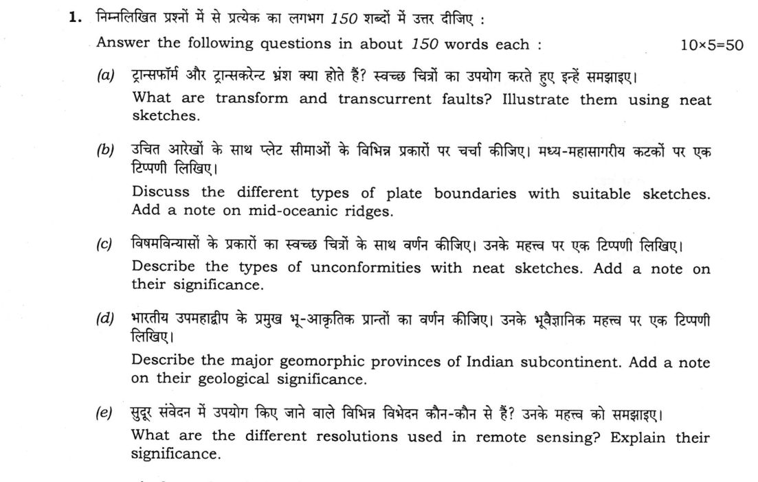
Answer the following questions in about 150 words each :
What are transform and transcurrent faults? Illustrate them using neat sketches. 10 marks
Discuss the different types of plate boundaries with suitable sketches. Add a note on mid-oceanic ridges. 10 marks
Describe the types of unconformities with neat sketches. Add a note on their significance. 10 marks
Describe the major geomorphic provinces of Indian subcontinent. Add a note on their geological significance. 10 marks
What are the different resolutions used in remote sensing? Explain their significance. 10 marks
हिंदी में प्रश्न पढ़ें
निम्नलिखित प्रश्नों में से प्रत्येक का लगभग 150 शब्दों में उत्तर दीजिए :
ट्रान्सफॉर्म और ट्रान्सकरेन्ट भ्रंश क्या होते हैं? स्वच्छ चित्रों का उपयोग करते हुए इन्हें समझाइए। (10 अंक)
उचित आरेखों के साथ प्लेट सीमाओं के विभिन्न प्रकारों पर चर्चा कीजिए। मध्य-महासागरीय कटकों पर एक टिप्पणी लिखिए। (10 अंक)
विषमविन्यासों के प्रकारों का स्वच्छ चित्रों के साथ वर्णन कीजिए। उनके महत्व पर एक टिप्पणी लिखिए। (10 अंक)
भारतीय उपमहाद्वीप के प्रमुख भू-आकृतिक प्रान्तों का वर्णन कीजिए। उनके भूवैज्ञानिक महत्व पर एक टिप्पणी लिखिए। (10 अंक)
सुदूर संवेदन में उपयोग किए जाने वाले विभिन्न विभेदन कौन-कौन से हैं? उनके महत्व को समझाइए। (10 अंक)
Model answer
Drafted with AI by UPSC Answer Check against this question's marking rubric, to the 150-word length. UPSC does not publish answers for Mains — this is one way to score well, not an official key. How we build rubrics and answers.
(a) Transform and transcurrent faults (10 marks)
A transform fault is a strike-slip fault that is itself a plate boundary, joining two offset ridge, trench or ridge–trench segments (a conservative margin). Slip is constant along the active segment and stops abruptly at the boundary junctions, beyond which the trace continues only as an inactive fracture zone. The slip sense is opposite to the apparent offset of the ridge (San Andreas Fault, Romanche fracture zone).
A transcurrent fault is a large strike-slip fault within a plate. It does not end at a plate boundary; slip dies out towards its tips or is taken up by folds and thrusts, and the slip sense agrees with the offset of markers (Great Glen Fault, Karakoram Fault).
Thus a transform fault is a plate boundary with constant slip, whereas a transcurrent fault is an intra-plate structure with dying-out slip.

(b) Types of plate boundaries and mid-oceanic ridges (10 marks)
Plate boundaries are of three kinds. Divergent: plates move apart, magma rises and new oceanic lithosphere forms (Mid-Atlantic Ridge, East African Rift). Convergent: one plate is subducted (ocean–ocean, Mariana arc; ocean–continent, Andes) or continents collide (Himalaya), giving trenches, volcanic arcs, deep earthquakes and fold mountains. Transform: plates slide past without creating or destroying lithosphere (San Andreas Fault).

Note on mid-oceanic ridges. They form a continuous submarine mountain chain about 65,000 km long, rising 2–3 km above the ocean floor, with a central rift valley. They are sites of spreading, pillow-basalt volcanism, shallow earthquakes and hydrothermal vents, and are offset by transform faults. The ocean floor becomes older and more sediment-covered away from the crest, with symmetrical magnetic stripes. Spreading rates range from about 2 cm/yr (Atlantic) to over 10 cm/yr (East Pacific Rise).
(c) Types of unconformities and their significance (10 marks)
An unconformity is a surface of erosion or non-deposition separating younger from older rocks.
- Angular unconformity: horizontal younger strata rest on tilted or folded older strata truncated by erosion.
- Disconformity: younger and older strata are parallel, separated by an irregular erosion surface.
- Nonconformity: sedimentary strata rest on eroded igneous or metamorphic rocks.
- Paraconformity: parallel strata with a flat, non-erosional break, recognised from fossils.

Significance. An unconformity records a hiatus with uplift, erosion and later subsidence or sea-level rise, often marked by a basal conglomerate. Angular unconformities record orogenic movements and are used to divide the stratigraphic record; missing strata hamper correlation. Unconformities also guide palaeogeography and host uranium ores (Athabasca) and hydrocarbon traps, and the Archaean–Cuddapah nonconformity marks the ancient Indian shield.
(d) Geomorphic provinces of the Indian subcontinent and their significance (10 marks)
The subcontinent has five major provinces. (1) The Himalayan mountain belt: young fold-thrust mountains, with the Greater, Lesser and Sub-Himalaya (Siwaliks) separated by the MCT, MBT and HFT. (2) The Indo-Gangetic-Brahmaputra plain: an alluvial foreland basin of thick Quaternary sediments. (3) The Peninsular plateau: an ancient shield of Archaean–Proterozoic rocks, with the Aravalli, Satpura, Western and Eastern Ghats and the Deccan Traps. (4) The coastal plains and deltas. (5) The islands (Andaman–Nicobar, Lakshadweep).
Significance. The Himalaya record the India–Eurasia collision and active tectonics; the plain holds groundwater and buried foredeep sediments; the plateau holds iron ore, manganese, gold, Gondwana coal and bauxite; the coastal basins hold hydrocarbons (Krishna–Godavari, Cambay) and beach placers; the Andaman arc records subduction.
(e) Resolutions in remote sensing and their significance (10 marks)
Resolution is the ability of a sensor to record detail.
- Spatial: the smallest ground area resolved (pixel size or IFOV), for example Landsat 30 m and Cartosat-2 about 1 m. It controls the scale of mapping, from regional lineaments to individual outcrops.
- Spectral: the number and narrowness of wavelength bands, from multispectral (Landsat-8, 11 bands) to hyperspectral (Hyperion, 220 bands). It allows minerals such as clays and alunite to be identified from absorption features in the SWIR.
- Radiometric: the sensitivity to differences in radiance, given by the number of bits (8-bit = 256 levels, 12-bit = 4096). It separates rocks of similar reflectance.
- Temporal: the revisit interval (Landsat 16 days, Sentinel-2 5 days), used to monitor landslides, floods, volcanic activity and shoreline change.
There is normally a trade-off between spatial, spectral and temporal resolution.
How this answer will be evaluated
Evaluation rubric
Each sub-part is marked on its own, against the marks and word limit printed on the paper.
- (a) Define transform and transcurrent faults, bring out the essential difference between them, and illustrate them with neat sketches (about 150 words). 10 marks · 150 words
Must cover
- Transform fault: strike-slip fault forming a plate boundary between two offset boundary segments (ridge–ridge, ridge–trench, trench–trench)
- Transform slip constant on the active segment and ending at the junctions, with an inactive fracture zone beyond; slip opposite to ridge offset
- Transcurrent fault: intra-plate strike-slip fault whose displacement dies out towards its tips
- Labelled sketches of both, with examples such as San Andreas and Great Glen or Karakoram faults
Loses marks
- Treating the two terms as identical.
- Sketch without labels or arrows.
- Describing them as dip-slip faults.
Earns more
- Statement of the difference in one line (plate boundary versus intra-plate, constant versus dying-out slip).
- Correct arrow directions in the sketches.
Extra mark
- Mention of the sense of motion being opposite to the ridge offset in transforms
- (b) Discuss the different types of plate boundaries with suitable sketches and add a note on mid-oceanic ridges (about 150 words). 10 marks · 150 words
Must cover
- Divergent, convergent (with ocean–ocean, ocean–continent, continent–continent) and transform boundaries with examples
- Sketches or cross-sections of the boundary types, labelled
- Mid-oceanic ridge: about 65,000 km long, central rift, spreading, pillow basalts, shallow earthquakes, transform offsets
- Magnetic stripes, ocean-floor age increasing away from the ridge, spreading rates
Loses marks
- Confusing constructive and destructive margins.
- No diagram.
- Omitting the separate note on ridges.
Earns more
- Correct example for each type.
- Link between ridges and divergent boundaries.
Extra mark
- Mention of hydrothermal vents or slow versus fast spreading ridges
- (c) Describe the types of unconformities with neat sketches and add a note on their significance (about 150 words). 10 marks · 150 words
Must cover
- Angular unconformity, disconformity, nonconformity and paraconformity, each defined
- Labelled sketches showing the erosion surface for each type
- Significance: hiatus, uplift and erosion, orogenic movement, stratigraphic subdivision, correlation problems
- Economic or palaeogeographic importance, with an example
Loses marks
- Confusing angular unconformity with disconformity.
- Sketch without an erosion surface.
- Omitting the significance note.
Earns more
- Basal conglomerate mentioned as an indicator.
- Each type distinguished by the attitude of the older strata.
Extra mark
- Indian example such as the Archaean–Cuddapah nonconformity, or uranium ores at unconformities
- (d) Describe the major geomorphic provinces of the Indian subcontinent and add a note on their geological significance (about 150 words). 10 marks · 150 words
Must cover
- Himalayan mountain belt with its subdivisions and the MCT, MBT and HFT
- Indo-Gangetic-Brahmaputra plain, Peninsular plateau, coastal plains and islands
- Geological character of each: young fold-thrust belt, alluvial foreland basin, ancient shield with Deccan Traps
- Significance: collision tectonics, groundwater and hydrocarbons, mineral wealth
Loses marks
- Listing physical divisions with no geological content.
- Placing the Deccan Traps in the Himalaya.
- Omitting the significance note.
Earns more
- Named ranges or basins in each province.
- Link of each province to its resources or hazards.
Extra mark
- Mention of the Andaman subduction arc
- (e) What are the different resolutions used in remote sensing? Explain their significance (about 150 words). 10 marks · 150 words
Must cover
- Spatial resolution: pixel size or IFOV, with example sensors and effect on mapping scale
- Spectral resolution: number and width of bands (multispectral versus hyperspectral) and mineral identification
- Radiometric resolution: number of bits and discrimination of small radiance differences
- Temporal resolution: revisit period and monitoring applications, with the trade-offs
Loses marks
- Confusing spectral with spatial resolution.
- Defining radiometric resolution as the number of pixels.
- Omitting temporal resolution.
Earns more
- Sensor examples for each resolution.
- Geological relevance for each.
Extra mark
- Statement of the trade-off between spatial, spectral and temporal resolution
What "Illustrate" is asking you to do
Carry the point with concrete cases rather than assert it, so the examples do the work of proving it. In the technical papers illustrate is often literal — a labelled diagram, a map, a graph — and an answer without the figure has not complied with the instruction.
Structure that answers it
The point stated → example 1 with the feature it demonstrates → example 2 → example 3 or the required diagram → what the set of examples establishes
Where marks are lost
Examples named and then abandoned. A case listed without the sentence showing what it demonstrates is marked as recall of information, not as illustration.
Practice this exact question
Write your answer and it is marked point by point against the model answer above — what you covered, what you missed, what you got wrong.
Evaluate my answer →More from Geology 2026 Paper I
- Q1 Answer the following questions in about 150 words each : (a) What are transform and trans…
- Q2 (a) Describe the principles of geological mapping. Using sketches, describe the different…
- Q3 (a) Discuss the importance of Remote Sensing (RS) and Geographic Information System (GIS)…
- Q4 (a) What is earthquake? How is the epicenter of an earthquake determined? Discuss on the…