Paper I — Q3
(a) Discuss the importance of Remote Sensing (RS) and Geographic Information System (GIS) in geological mapping. Elucidate the…
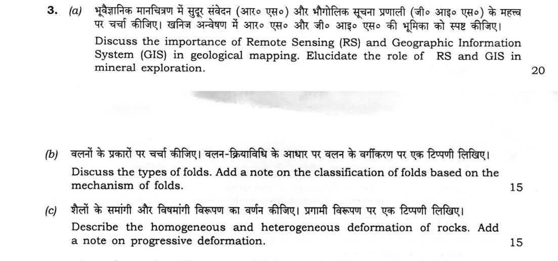
Discuss the importance of Remote Sensing (RS) and Geographic Information System (GIS) in geological mapping. Elucidate the role of RS and GIS in mineral exploration. 20 marks
Discuss the types of folds. Add a note on the classification of folds based on the mechanism of folds. 15 marks
Describe the homogeneous and heterogeneous deformation of rocks. Add a note on progressive deformation. 15 marks
हिंदी में प्रश्न पढ़ें
भूवैज्ञानिक मानचित्रण में सुदूर संवेदन (आर० एस०) और भौगोलिक सूचना प्रणाली (जी० आई० एस०) के महत्व पर चर्चा कीजिए। खनिज अन्वेषण में आर० एस० और जी० आई० एस० की भूमिका को स्पष्ट कीजिए। (20 अंक)
वलनों के प्रकारों पर चर्चा कीजिए। वलन-क्रियाविधि के आधार पर वलन के वर्गीकरण पर एक टिप्पणी लिखिए। (15 अंक)
शैलों के समांगी और विषमांगी विरूपण का वर्णन कीजिए। प्रगामी विरूपण पर एक टिप्पणी लिखिए। (15 अंक)
Model answer
Drafted with AI by UPSC Answer Check against this question's marking rubric, to the expected length. UPSC does not publish answers for Mains — this is one way to score well, not an official key. How we build rubrics and answers.
(a) Remote sensing and GIS in geological mapping and mineral exploration (20 marks)
Remote sensing in geological mapping. Satellite and aerial data give a synoptic view of large and inaccessible terrain, saving field time and cost. Tone, texture, drainage and relief separate rock units, and multispectral bands discriminate lithology. Lineaments, faults, folds, dykes and geomorphic features are seen directly, so that a photogeological base map guides the field traverses and reduces the ground work. Repeat coverage helps in mapping landslides, floods and active faults.
GIS in geological mapping. A geographic information system stores, integrates and analyses spatially referenced data as layers: geology, structure, topography, drainage, geophysics, geochemistry and remote-sensing images. Digital maps can be edited and updated, queried, overlaid and printed at any scale, and the database is shared through portals such as GSI's Bhukosh. It also supports 3D models and DEM-based analysis, such as slope and structural attitudes.
Role in mineral exploration. Remote sensing maps favourable host rocks, structures controlling mineralisation, and hydrothermal alteration zones, such as iron-oxide gossans and clay or alunite halos, from their spectral signatures in the visible, SWIR and thermal bands. GIS then integrates these layers with geophysical and geochemical anomalies and drill-hole data; buffer and overlay analysis, weights-of-evidence and fuzzy-logic models yield a prospectivity map, so that targets are ranked and drilling is directed to them at lower cost.
(b) Types of folds and classification by mechanism of folding (15 marks)
Types of folds. Folds are classified geometrically as follows.
- By shape: anticline and syncline (antiform and synform), dome and basin, monocline, and forms such as chevron, box, fan and isoclinal folds.
- By attitude of the axial plane and hinge line: upright, inclined, overturned and recumbent (figure); horizontal or plunging.
- By interlimb angle: gentle (180–120°), open (120–70°), close (70–30°), tight (30–0°) and isoclinal (0°).
- By symmetry: symmetrical and asymmetrical, and by layer thickness, Ramsay's classes 1A, 1B, 1C, 2 and 3, which use dip isogons, distinguishing parallel folds (1B) from similar folds (2).

Classification by mechanism.
- Buckling (flexural folding): a competent layer shortened parallel to itself, either by flexural slip between layers or by flexural flow within them, giving parallel folds.
- Passive (shear) folding: layers act only as markers and are folded by slip along closely spaced planes, or by flow, giving similar folds.
- Bending: forces perpendicular to the layering, as in folds over uplifted blocks.
- Drape (forced) folding: cover strata folded over a faulted basement block.
(c) Homogeneous and heterogeneous deformation, and progressive deformation (15 marks)
Homogeneous deformation. The strain is the same at every point of the body. Straight lines remain straight, parallel lines remain parallel, and a circle becomes an ellipse (the strain ellipse) of the same shape everywhere. Pure shear and simple shear are examples, and a small part of a rock can often be treated as homogeneous.
Heterogeneous deformation. The strain varies from point to point. Straight lines become curved, parallel lines are no longer parallel, and a circle is distorted into different shapes at different places. Folds, boudinage, shear zones and most real rock bodies show it.

Contrast. In homogeneous strain, one strain ellipse describes the whole body and the strain can be calculated simply; in heterogeneous strain, the strain has to be described point by point. The distinction depends on scale.
Progressive deformation. Deformation builds up as a series of small incremental strains along a strain path. The finite strain is their cumulative result and is not a simple sum when axes rotate. In coaxial deformation (pure shear) the axes stay fixed, and in non-coaxial deformation (simple shear) they rotate relative to the material. Consequences include the growth of foliation and lineation, the rotation and folding of veins, boudinage, sigmoidal fabrics and porphyroclast rotation, shear-zone development and the amplification of folds.
How this answer will be evaluated
Evaluation rubric
Each sub-part is marked on its own, against the marks and word limit printed on the paper.
- (a) Discuss the importance of remote sensing (RS) and GIS in geological mapping, and elucidate the role of RS and GIS in mineral exploration (20 marks). 20 marks
Must cover
- RS in mapping: synoptic view, lithological discrimination, lineaments and structure, photogeological base map, less field time
- GIS in mapping: layered spatial database, integration of geology, geophysics, geochemistry and RS, digital updating, DEM and 3D analysis
- RS in exploration: host rocks, structural controls and hydrothermal alteration (iron oxide, clay, alunite) from spectral signatures
- GIS in exploration: data integration, overlay and buffer analysis, weights-of-evidence or fuzzy prospectivity modelling, target ranking
Loses marks
- Merging GIS into remote sensing.
- Only general statements with no exploration application.
- Describing GPS instead of GIS.
Earns more
- RS and GIS treated separately for both mapping and exploration.
- Specific examples of alteration minerals or data layers.
Extra mark
- Mention of GSI's Bhukosh or hyperspectral and ASTER data
- (b) Discuss the types of folds and add a note on the classification of folds based on the mechanism of folding (15 marks). 15 marks
Must cover
- Geometric types: anticline and syncline, dome and basin, monocline, and forms such as chevron, box and isoclinal
- Classification by axial plane attitude (upright, inclined, overturned, recumbent), plunge and interlimb angle (gentle to isoclinal)
- Ramsay's classes or parallel versus similar folds
- Mechanism: buckling (flexural slip and flow), passive or shear folding, bending, drape or forced folds
Loses marks
- Confusing anticline with antiform without ever defining them.
- Omitting the mechanism note.
- Mixing up parallel and similar folds.
Earns more
- A labelled sketch of the fold types.
- Each mechanism linked to the fold geometry it produces.
Extra mark
- Mention of kink or chevron folds and of the role of layer competence
- (c) Describe homogeneous and heterogeneous deformation of rocks and add a note on progressive deformation (15 marks). 15 marks
Must cover
- Homogeneous strain: uniform, straight parallel lines stay straight and parallel, circle becomes an ellipse
- Heterogeneous strain: variable, lines curve, with folds, boudins and shear zones as examples
- Contrast of the two, including the effect of scale
- Progressive deformation: incremental strains along a strain path, finite strain, coaxial versus non-coaxial, structural consequences
Loses marks
- Confusing strain with stress.
- Treating progressive deformation as a single event.
- Omitting the contrast between the two types.
Earns more
- Strain-ellipse or grid sketch for both types.
- Named structures that develop progressively.
Extra mark
- Mention of pure shear and simple shear as end members
What "Elucidate" is asking you to do
Make a stated proposition plain and then prove it with instances. Elucidate stems almost always carry a claim or a named concept, and very often the words “with examples” or “with suitable diagrams” — the illustration is part of the directive, not decoration.
Structure that answers it
Plain-language statement of what the proposition means → the part that is obscure, resolved → first illustration → second illustration → why the proposition holds
Where marks are lost
Adding terminology; elucidate rewards removing it. The commoner loss is a clean explanation with no example, when the stem asked for examples.
Practice this exact question
Write your answer and it is marked point by point against the model answer above — what you covered, what you missed, what you got wrong.
Evaluate my answer →More from Geology 2026 Paper I
- Q1 Answer the following questions in about 150 words each : (a) What are transform and trans…
- Q2 (a) Describe the principles of geological mapping. Using sketches, describe the different…
- Q3 (a) Discuss the importance of Remote Sensing (RS) and Geographic Information System (GIS)…
- Q4 (a) What is earthquake? How is the epicenter of an earthquake determined? Discuss on the…
- Q5 Answer the following questions in about 150 words each : (a) Discuss the conditions requi…
- Q6 (a) Compare the major morphological characters which differentiate Hominidae from ape-lik…