Paper I — Q2
(a) Describe the principles of geological mapping. Using sketches, describe the different types of symbols used in geological…
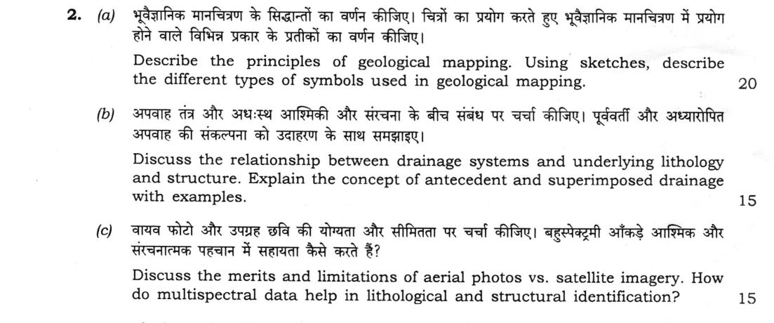
Describe the principles of geological mapping. Using sketches, describe the different types of symbols used in geological mapping. 20 marks
Discuss the relationship between drainage systems and underlying lithology and structure. Explain the concept of antecedent and superimposed drainage with examples. 15 marks
Discuss the merits and limitations of aerial photos vs. satellite imagery. How do multispectral data help in lithological and structural identification? 15 marks
हिंदी में प्रश्न पढ़ें
भूवैज्ञानिक मानचित्रण के सिद्धान्तों का वर्णन कीजिए। चित्रों का प्रयोग करते हुए भूवैज्ञानिक मानचित्रण में प्रयोग होने वाले विभिन्न प्रकार के प्रतीकों का वर्णन कीजिए। (20 अंक)
अपवाह तंत्र और अधःस्थ आश्मिकी और संरचना के बीच संबंध पर चर्चा कीजिए। पूर्ववर्ती और अध्यारोपित अपवाह की संकल्पना को उदाहरण के साथ समझाइए। (15 अंक)
वायव फोटो और उपग्रह छवि की योग्यता और सीमितता पर चर्चा कीजिए। बहुस्पेक्ट्रमी आँकड़े आश्मिक और संरचनात्मक पहचान में सहायता कैसे करते हैं? (15 अंक)
Model answer
Drafted with AI by UPSC Answer Check against this question's marking rubric, to the expected length. UPSC does not publish answers for Mains — this is one way to score well, not an official key. How we build rubrics and answers.
(a) Principles of geological mapping and map symbols (20 marks)
Geological mapping is the plotting of rock units, their contacts and structures on a base map by direct field observation. Its principles are as follows.
- A suitable base map (topographic sheet or air photo) is chosen, at a scale to suit the purpose (1:50,000 for regional and 1:10,000 or larger for detailed work), and studied beforehand with photo and satellite interpretation and earlier reports.
- The area is mapped in traverses across the strike, or by tracing contacts, with each observation located by GPS or compass and pacing.
- Mappable units are defined on distinctive lithology, and are recorded with their contacts, attitude (strike and dip), fossils, structures (folds, faults, joints, foliation) and samples.
- The laws of superposition, original horizontality and cross-cutting relations are used to interpret the sequence, and the rule of V's is used to relate outcrop pattern to dip and relief.
- Contacts are followed, correlated and drawn, a legend, cross-section and stratigraphic column are prepared, and the map is checked in the field.
Symbols. The signs fall into categories: bedding attitude (inclined, horizontal, vertical, overturned); contacts (observed, inferred, concealed); faults (normal, thrust, strike-slip); folds (anticline, syncline, plunge); unconformity; and other features (joints, foliation, dykes, fossil localities, samples and bore holes).

(b) Drainage in relation to lithology and structure; antecedent and superimposed drainage (15 marks)
Lithology. Resistant, impermeable rocks such as shale and clay give a high drainage density, while permeable rocks such as sandstone and limestone give a low density; in karst, streams vanish underground. Homogeneous rocks or horizontal strata develop a dendritic pattern.
Structure. Alternating hard and soft folded strata give a trellis pattern, with subsequent streams along the strike of the weak beds. Joints and faults in massive rocks give a rectangular or angular pattern. Domes and volcanic cones give a radial pattern, basins a centripetal pattern, and eroded domes an annular pattern. Faults also produce linear valleys and offset streams.
Antecedent drainage is a river that existed before an uplift and kept its course by cutting down as fast as the land rose, forming a gorge across the rising range. The Indus, Sutlej and Brahmaputra (Dihang gorge) crossing the Himalaya are examples.
Superimposed drainage is a river that was established on an overlying younger cover, and was lowered on to the older, structurally different rocks beneath, cutting across their structure with no adjustment to it. Examples are the Subarnarekha and Chambal in India and the Green River across the Uinta Mountains in the USA.
(c) Aerial photographs and satellite imagery; multispectral data (15 marks)
Aerial photographs. Merits: very high spatial resolution, stereoscopic coverage giving relief, dip and structure, flexible timing and scale, and low cost for small areas. Limitations: a small area per photo (so many are needed), scale variation and relief displacement, a limited spectral range, and costly repeat coverage.
Satellite imagery. Merits: synoptic, repetitive coverage of large or inaccessible areas, multispectral and thermal bands, digital data suited to processing and GIS, and low cost per unit area. Limitations: coarser resolution (except costly high-resolution data), cloud cover, limited stereo, and atmospheric effects.
Multispectral data. Rocks reflect and absorb differently in different bands, so combining bands identifies lithology. Iron oxides absorb in the visible and near-infrared, clays and carbonates absorb in the SWIR (about 2.2 and 2.3 μm), and silicate rocks are separated by thermal-infrared emissivity. False-colour composites, band ratios, principal components and classification map rock units. Structures are recognised from lineaments, offsets, tonal and drainage anomalies, and from fold-shaped outcrop patterns, which are enhanced by filtering and combined with DEMs.
How this answer will be evaluated
Evaluation rubric
Each sub-part is marked on its own, against the marks and word limit printed on the paper.
- (a) Describe the principles of geological mapping and, with sketches, the different types of symbols used in geological mapping (20 marks; the symbol sketches are compulsory). 20 marks
Must cover
- Principles: base map and scale, prior study, traverses and contact tracing, location of observations
- Recording of lithology, contacts, strike and dip, structures and samples; laws of superposition, original horizontality and cross-cutting; V-rule
- Symbol categories: bedding attitude, contacts, faults, folds, unconformity, other features
- Drawn symbols: strike and dip, horizontal and vertical beds, solid, dashed and dotted contacts, fault and fold signs
Loses marks
- No drawn symbols.
- Describing only the topographic map symbols.
- Confusing strike with dip in the symbols.
Earns more
- Post-field work: legend, cross-section, stratigraphic column, field check.
- Correct and recognisable conventional signs in the sketch.
Extra mark
- Mention of GPS, air photos or satellite data in mapping
- (b) Discuss the relationship between drainage systems and underlying lithology and structure, and explain antecedent and superimposed drainage with examples (15 marks). 15 marks
Must cover
- Lithology control: drainage density and permeability, dendritic pattern on homogeneous rocks
- Structure control: trellis, rectangular, radial, centripetal and annular patterns with their causes
- Antecedent drainage defined, with Himalayan examples (Indus, Sutlej, Brahmaputra)
- Superimposed drainage defined, with an example
Loses marks
- Confusing antecedent with superimposed drainage.
- Patterns listed without geological causes.
- No examples.
Earns more
- Link of each pattern to its cause.
- Difference between the two drainage concepts stated.
Extra mark
- Mention of faults giving linear valleys and offset streams
- (c) Discuss the merits and limitations of aerial photographs versus satellite imagery, and how multispectral data help in lithological and structural identification (15 marks). 15 marks
Must cover
- Aerial photographs: high resolution and stereo as merits; small coverage, distortion and limited spectral range as limitations
- Satellite imagery: synoptic, repetitive, multispectral and digital as merits; coarser resolution, clouds and cost as limitations
- Multispectral lithology: iron oxide, clay/carbonate SWIR and thermal-infrared silicate signatures
- Processing and structure: composites, ratios, lineaments and fold patterns
Loses marks
- One-sided comparison.
- Saying multispectral data give only colour images.
- No link to lithology or structure.
Earns more
- Both merits and limitations given for each source, not a one-sided list.
- Specific wavelengths or minerals named.
Extra mark
- Mention of DEMs, SAR or stereo satellites such as Cartosat
What "Describe" is asking you to do
Give a full, ordered account of the thing named — its parts, stages or mechanism — in the sequence in which it actually exists or occurs. Most describe questions come from the science optionals, where the marks sit in correct technical detail and, where the stem says so, a labelled diagram.
Structure that answers it
One-line identification of the subject → the parts or stages in their real order, each with its defining detail → labelled diagram where the subject is structural → closing line on function or significance
Where marks are lost
Loose general prose where the examiner is ticking named parts, correct terminology and their sequence; and in the General Studies papers, turning to evaluation before the description is finished.
Practice this exact question
Write your answer and it is marked point by point against the model answer above — what you covered, what you missed, what you got wrong.
Evaluate my answer →More from Geology 2026 Paper I
- Q1 Answer the following questions in about 150 words each : (a) What are transform and trans…
- Q2 (a) Describe the principles of geological mapping. Using sketches, describe the different…
- Q3 (a) Discuss the importance of Remote Sensing (RS) and Geographic Information System (GIS)…
- Q4 (a) What is earthquake? How is the epicenter of an earthquake determined? Discuss on the…
- Q5 Answer the following questions in about 150 words each : (a) Discuss the conditions requi…