Paper I — Q4
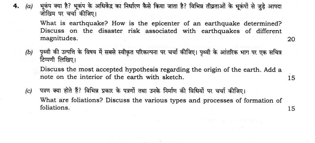
(a) What is earthquake? How is the epicenter of an earthquake determined? Discuss on the disaster risk associated with…
What is earthquake? How is the epicenter of an earthquake determined? Discuss on the disaster risk associated with earthquakes of different magnitudes. 20 marks
Discuss the most accepted hypothesis regarding the origin of the earth. Add a note on the interior of the earth with sketch. 15 marks
What are foliations? Discuss the various types and processes of formation of foliations. 15 marks
हिंदी में प्रश्न पढ़ें
भूकंप क्या है? भूकंप के अधिकेंद्र का निर्धारण कैसे किया जाता है? विभिन्न तीव्रताओं के भूकंपों से जुड़े आपदा जोखिम पर चर्चा कीजिए। (20 अंक)
पृथ्वी की उत्पत्ति के विषय में सबसे स्वीकृत परिकल्पना पर चर्चा कीजिए। पृथ्वी के आंतरिक भाग पर एक सचित्र टिप्पणी लिखिए। (15 अंक)
पत्रण क्या होते हैं? विभिन्न प्रकार के पत्रणों तथा उनके निर्माण की विधियों पर चर्चा कीजिए। (15 अंक)
Model answer
Drafted with AI by UPSC Answer Check against this question's marking rubric, to the expected length. UPSC does not publish answers for Mains — this is one way to score well, not an official key. How we build rubrics and answers.
(a) Earthquake, location of the epicentre and disaster risk (20 marks)
Definition. An earthquake is a sudden release of accumulated elastic strain energy in the crust or upper mantle, usually by slip on a fault, that radiates as seismic waves and shakes the ground. The point of rupture is the focus (hypocentre) and the point on the surface directly above it is the epicentre.
Location of the epicentre. Seismographs record the arrival of P waves and then the slower S waves. The S–P interval at a station increases with distance, and travel-time curves convert it to the epicentral distance (roughly 8 km for every second of interval). A circle of this radius is drawn on a map around each station; the circles from three or more stations intersect at the epicentre (triangulation). Focal depth is found from depth phases such as pP, and today the location is computed from many stations by inversion.
Disaster risk with magnitude. Magnitude is logarithmic: each unit means ten times the amplitude and about 32 times the energy.
- Below 3: recorded only by instruments, no risk.
- 3 to 4.9: felt, with minor or no damage.
- 5 to 5.9: damage to poorly built structures near the epicentre.
- 6 to 6.9: destructive within about 100 km, as at Latur (1993, magnitude 6.2, shallow, about 10,000 deaths).
- 7 to 7.9: heavy damage over a wide area, as at Bhuj (2001, magnitude 7.7).
- 8 and above: devastation over hundreds of kilometres, often with tsunami, as at Sumatra (2004, magnitude 9.1).
The actual risk also depends on focal depth, distance, soft soil (which amplifies shaking and liquefies), the quality of construction, population density and secondary effects such as landslides, tsunami and fire. India is divided into seismic zones II to V, with the Himalaya and the north-east in zone V.
(b) Origin of the Earth and interior of the Earth (15 marks)
Origin. The most accepted hypothesis is the modern nebular (solar-nebula) model. About 4.6 billion years ago a fragment of a molecular cloud collapsed under gravity, and, because of its spin, flattened into a rotating disc with the proto-Sun at its centre. Dust in the disc condensed and stuck together into planetesimals, which merged into protoplanets. The inner disc gave rocky planets, and the cold outer disc gave gas and ice giants. Earth then heated by accretion, impacts and radioactivity, and the molten iron sank to form the core, leaving the mantle and crust; a giant impact formed the Moon.
Support. The planets orbit in the same direction and nearly in one plane; meteorite ages are 4.56 billion years; the composition changes from rocky to gaseous with distance; and discs are observed around young stars.
Interior. Seismic waves show layers (figure): the crust, the mantle down to 2900 km and the core, of which the outer core is liquid, since S waves do not pass through it, and the inner core is solid.

(c) Foliation: types and processes of formation (15 marks)
Definition. Foliation is a planar fabric formed in deformed and metamorphic rocks by the parallel alignment or layering of minerals, and usually lies perpendicular to the direction of maximum shortening.
Types.
- Slaty cleavage: very fine, closely spaced, giving splitting into thin plates in slate; the grains are microscopic.
- Phyllitic foliation: slightly coarser grains, giving a silky sheen on the surface.
- Schistosity: platy or elongate minerals, such as mica, visible to the naked eye, in schist.
- Gneissic banding: coarse alternating light and dark mineral bands in gneiss.
- Spaced (crenulation) cleavage: discrete cleavage planes separated by uncleaved rock, and mylonitic foliation in shear zones.
Processes of formation.
- Mechanical rotation: platy grains are rotated into the plane perpendicular to the maximum compressive stress.
- Pressure solution: soluble minerals such as quartz and calcite dissolve at grain contacts and move away, concentrating insoluble mica and clay in cleavage seams.
- Recrystallisation and neocrystallisation: new mica and other minerals grow with preferred orientation under stress and heat.
- Flattening of grains and dynamic recrystallisation, and metamorphic differentiation, which segregates minerals into bands (gneissic banding).
- Shearing in ductile shear zones, which produces mylonitic foliation.
How this answer will be evaluated
Evaluation rubric
Each sub-part is marked on its own, against the marks and word limit printed on the paper.
- (a) What is an earthquake? How is the epicentre of an earthquake determined? Discuss the disaster risk associated with earthquakes of different magnitudes (20 marks). 20 marks
Must cover
- Definition: sudden release of elastic strain energy giving seismic waves; focus and epicentre defined
- Epicentre by S–P interval at three or more stations, distance circles and triangulation
- Magnitude scale is logarithmic (10× amplitude, about 32× energy); risk graded from minor to great earthquakes
- Other controls on risk: depth, soil amplification and liquefaction, construction, population, secondary hazards; Indian examples and seismic zones
Loses marks
- Giving only the definition.
- Saying the epicentre is found from one station.
- Equating magnitude with intensity.
Earns more
- Method explained, not only stated: travel-time curves and intersection of circles.
- Examples with magnitude and impact (Latur, Bhuj, Sumatra).
Extra mark
- Mention of depth phases or computer inversion, and of Indian zones II–V
- (b) Discuss the most accepted hypothesis regarding the origin of the Earth and add a note on the interior of the Earth with a sketch (15 marks). 15 marks
Must cover
- Nebular (solar-nebula) hypothesis: collapse of a cloud into a rotating disc, planetesimals, protoplanets
- Supporting evidence: planetary orbits, meteorite age of 4.56 Ga, compositional zoning, observed protoplanetary discs
- Early Earth: accretion, differentiation into core, mantle and crust, and the giant impact origin of the Moon
- Interior with a labelled sketch: crust, mantle, outer core (liquid) and inner core (solid), with depths and seismic evidence
Loses marks
- Presenting a discredited hypothesis (tidal or collision) as the accepted one.
- Sketch without labels or depths.
- Omitting the evidence.
Earns more
- Depths and the discontinuities (Moho, Gutenberg, Lehmann) marked.
- Use of S-wave shadow to show the liquid outer core.
Extra mark
- Mention of the asthenosphere or the transition zone
- (c) What are foliations? Discuss the various types and the processes of formation of foliations (15 marks). 15 marks
Must cover
- Definition: planar fabric of aligned minerals or layering, normal to maximum shortening
- Types: slaty cleavage, phyllitic foliation, schistosity, gneissic banding, spaced or crenulation cleavage
- Processes: mechanical rotation, pressure solution, recrystallisation and neocrystallisation
- Further processes: flattening, metamorphic differentiation and shear-zone (mylonitic) foliation
Loses marks
- Confusing foliation with bedding.
- Listing types without any process.
- Stating foliation is parallel to the maximum compressive stress.
Earns more
- Grain size or metamorphic grade linked to each type.
- Each process explained with its effect on the fabric.
Extra mark
- Relation of foliation to the axial planes of folds
What "Discuss" is asking you to do
Lay the issue out from more than one side — how it arose, what is claimed for it, what is held against it, and where it now stands. UPSC attaches discuss to broad topics with several live dimensions, so coverage of the dimensions earns more than the strength of your opinion.
Structure that answers it
Set the issue up → the case as it is made → the case against → the dimension both sides leave out → where the balance now lies
Where marks are lost
Listing facts with no thread between them, or arguing one side throughout and calling it a discussion.
Practice this exact question
Write your answer and it is marked point by point against the model answer above — what you covered, what you missed, what you got wrong.
Evaluate my answer →More from Geology 2026 Paper I
- Q1 Answer the following questions in about 150 words each : (a) What are transform and trans…
- Q2 (a) Describe the principles of geological mapping. Using sketches, describe the different…
- Q3 (a) Discuss the importance of Remote Sensing (RS) and Geographic Information System (GIS)…
- Q4 (a) What is earthquake? How is the epicenter of an earthquake determined? Discuss on the…
- Q5 Answer the following questions in about 150 words each : (a) Discuss the conditions requi…
- Q6 (a) Compare the major morphological characters which differentiate Hominidae from ape-lik…
- Q7 (a) Discuss the stratigraphic classification and depositional environment of Cuddapah Sup…