Paper I — Q2
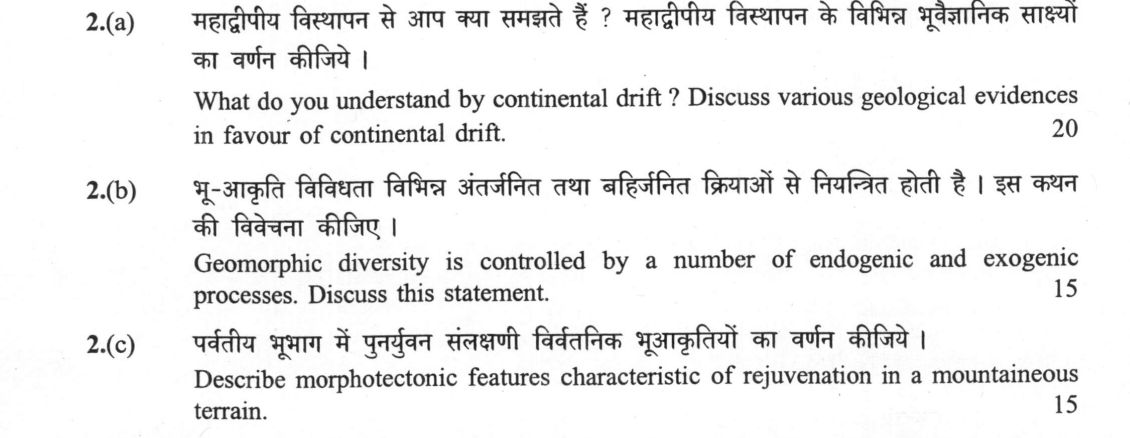
(a) What do you understand by continental drift ? Discuss various geological evidences in favour of continental drift. (20…
What do you understand by continental drift ? Discuss various geological evidences in favour of continental drift. 20 marks
Geomorphic diversity is controlled by a number of endogenic and exogenic processes. Discuss this statement. 15 marks
Describe morphotectonic features characteristic of rejuvenation in a mountaineous terrain. 15 marks
हिंदी में प्रश्न पढ़ें
महाद्वीपीय विस्थापन से आप क्या समझते हैं ? महाद्वीपीय विस्थापन के विभिन्न भूवैज्ञानिक साक्ष्यों का वर्णन कीजिये । (20 अंक)
भू-आकृति विविधता विभिन्न अंतर्जनित तथा बहिर्जनित क्रियाओं से नियंत्रित होती है । इस कथन की विवेचना कीजिए । (15 अंक)
पर्वतीय भूभाग में पुनर्युवन संलक्षणी विवर्तनिक भूआकृतियों का वर्णन कीजिये । (15 अंक)
Model answer
Written by UPSC Answer Check against this question's marking rubric, to the expected length. UPSC does not publish answers for Mains — this is one way to score well, not an official key.
Continental Drift and Geological Evidences
Alfred Wegener (1912) postulated the Continental Drift hypothesis, proposing that Earth's landmasses were once assembled into a single supercontinent, Pangea, surrounded by the super-ocean Panthalassa, before rifting and drifting apart during the Mesozoic. Multiple lines of empirical evidence corroborate this reconstruction:
Morphological Jigsaw-Fit: The complementary geometric match between continental margins across the Atlantic, most notably the Atlantic coastlines of South America and Africa, verified statistically at the 1,000-metre isobath by Edward Bullard.
Stratigraphic and Structural Continuity: Pre-drift orogenic belts and cratonic boundaries terminate abruptly at continental edges and resume seamlessly across oceans. The Paleozoic Appalachian belt of North America aligns directly with the Caledonian fold belt of the British Isles and Scandinavia. Similarly, Archean cratons and mobile belts match precisely between Brazil and West Africa.
Palaeontological Correlations: Terrestrial and freshwater fossil taxa with restricted dispersal capabilities occur across widely separated Gondwanan continents. The tongue-fern Glossopteris flora, the early aquatic reptile Mesosaurus (found only in South Africa and eastern South America), and terrestrial reptiles Lystrosaurus and Cynognathus provide compelling proof of contiguous landmasses.
Palaeoclimatic Markers: Permo-Carboniferous glacial deposits, such as the Talchir tillites of India, Dwyka tillites of South Africa, and contemporaneous diamictites in South America, Australia, and Antarctica, show radiating glacial striations from a common polar centre, impossible under current latitudinal configurations.
Palaeomagnetism: Apparent Polar Wander (APW) paths from different cratons diverge historically but converge into a single path when continents are restored to Wegenerian fits.
While Wegener's mechanism—invoking tidal friction and differential gravitational forces—proved physically inadequate, the hypothesis was later vindicated and integrated into modern Plate Tectonics driven by mantle convection and slab pull.
Geomorphic Diversity: Endogenic and Exogenic Controls
Landscape diversity is governed by the coupled interaction between endogenic processes, which generate crustal relief and structural templates, and exogenic processes, which denude and sculpt these structures under varying climatic regimes.
Endogenic controls involve volcanism, faulting, folding, and isostasy. In peninsular India, Cretaceous flood basalt volcanism formed the distinct step-like stepped trappean topography of the Deccan Traps. In northeast India, intraplate compressive stresses drive the pop-up tectonic uplift of the Meghalaya Plateau along the Dauki and Brahmaputra boundary faults.
Exogenic controls—weathering, mass wasting, fluvial, aeolian, and glacial erosion—work to modify these endogenic templates. Climate dictates the dominant agent: in hyper-arid western Rajasthan, wind action sculpts the barchans and seif dunes of the Thar desert upon an otherwise stable craton. Conversely, along the passive rifted margin of the Western Ghats, heavy monsoonal precipitation drives intense chemical weathering, scarp retreat, and deep fluvial incising. Geomorphic diversity is thus the transient expression of tectonic uplift counterbalanced by climatically modulated surface denudation.
Morphotectonic Features of Rejuvenation
Rejuvenation occurs when a geomorphic cycle is interrupted by a drop in base level, caused either by epeirogenic/tectonic uplift or glacio-eustasy, which restores potential energy to fluvial systems. In mountainous terrains, characteristic morphotectonic signatures include:
Knickpoints and Waterfalls: Abrupt gradient changes along river longitudinal profiles, indicating the upstream migration of an incision wave (e.g., hanging valleys and prominent knickpoints along the Western Ghats scarp).
Incised Meanders: Entrenched and ingrown meanders produced when low-gradient, mature meandering streams are subjected to rapid vertical incision without altering their planform geometry, as seen in the Bhagirathi and Alaknanda gorges of the Higher Himalayas.
Fluvial Terraces: Step-like, paired and unpaired abandoned floodplains flanking valleys, documenting pulsed tectonic uplift in the Siwalik foothill belt and the intermontane Dun valleys.
Antecedent Drainage: Rivers that maintain their pre-existing courses by incising at a rate equal to or exceeding tectonic uplift, carving profound transverse gorges (e.g., Indus, Sutlej, and Brahmaputra across the rising Himalayan ranges).
Elevated Planation Surfaces: Relict peneplains uplifted to high elevations, bounded by sharp fault scarps and undergoing fresh dissecting erosion.
Modern geomorphology recognises that these rejuvenation features represent a complex interplay between active tectonic orogeny and continuous isostatic rebound triggered by erosional unloading. Moving forward, integrating high-resolution Digital Elevation Models (DEMs) with cosmogenic radionuclide dating provides critical quantification of whether individual landforms stem primarily from deep-seated geodynamic drift, localized tectonic rejuvenation, or climatic oscillations.
What "Discuss" is asking you to do
Lay the issue out from more than one side — how it arose, what is claimed for it, what is held against it, and where it now stands. UPSC attaches discuss to broad topics with several live dimensions, so coverage of the dimensions earns more than the strength of your opinion.
Structure that answers it
Set the issue up → the case as it is made → the case against → the dimension both sides leave out → where the balance now lies
Where marks are lost
Listing facts with no thread between them, or arguing one side throughout and calling it a discussion.
How this answer will be evaluated
Approach
(a) discuss: intro > 3-4 dimensions > example > balanced close | (b) discuss: intro > 3-4 dimensions > example > balanced close | (c) describe: define > structure or process in order > labelled diagram > significance Full marks: Comprehensive, well-structured answers with precise terminology, relevant examples, and clear diagrams.
Key points expected
- Definition of continental drift (Wegener's hypothesis)
- Fit of continental margins (e.g., South America/Africa)
- Fossil evidence (e.g., Glossopteris, Mesosaurus)
- Rock type and structural continuity across oceans
- Definition of endogenic processes (e.g., tectonics, volcanism)
- Definition of exogenic processes (e.g., weathering, erosion)
- Explanation of interaction between internal and external forces
- Examples of landforms created by these processes
Evaluation rubric
Each sub-part is marked on its own, against the marks and word limit printed on the paper.
- (a) Definition of continental drift and a discussion of geological evidence supporting it. 20 marks
discuss— intro → 3-4 dimensions → example → balanced close
Must cover
- Definition of continental drift (Wegener's hypothesis)
- Fit of continental margins (e.g., South America/Africa)
- Fossil evidence (e.g., Glossopteris, Mesosaurus)
- Rock type and structural continuity across oceans
Loses marks
- Listing evidence without explaining its significance
- Confusing continental drift with plate tectonics
- Missing the definition of the concept
Earns more
- Paleomagnetic evidence (apparent polar wander paths)
- Glacial evidence (Permian glacial striations)
- Diagram of Pangaea reconstruction
Extra mark
- Mention of specific Indian formations (e.g., Gondwana)
- Reference to specific paleomagnetic data
- (b) Discussion of how endogenic and exogenic processes control geomorphic diversity. 15 marks
discuss— intro → 3-4 dimensions → example → balanced close
Must cover
- Definition of endogenic processes (e.g., tectonics, volcanism)
- Definition of exogenic processes (e.g., weathering, erosion)
- Explanation of interaction between internal and external forces
- Examples of landforms created by these processes
Loses marks
- Defining processes without linking to landform diversity
- Ignoring the interaction between endogenic and exogenic forces
- Vague generalities without specific examples
Earns more
- Mention of specific Indian landforms (e.g., Himalayas, Deccan Traps)
- Discussion of time scales of these processes
- Diagram illustrating the interplay of forces
Extra mark
- Reference to specific Indian geological events
- Mention of specific geomorphic cycles (e.g., Davis, Penck)
- (c) Description of morphotectonic features characteristic of rejuvenation in mountainous terrain. 15 marks
describe— define → structure or process in order → labelled diagram → significance
Must cover
- Definition of rejuvenation (uplift of eroded landforms)
- Description of incised meanders
- Description of knickpoints and waterfalls
- Description of steepened valley profiles
Loses marks
- Confusing rejuvenation with general erosion
- Failing to describe specific morphotectonic features
- Ignoring the mountainous terrain context
Earns more
- Mention of specific Indian examples (e.g., Narmada, Tapi)
- Discussion of the causes of rejuvenation (e.g., tectonic uplift)
- Diagram showing a rejuvenated river profile
Extra mark
- Reference to specific Indian mountain ranges
- Mention of specific geological time periods
Practice this exact question
Write your answer and it is marked point by point against the model answer above — what you covered, what you missed, what you got wrong.
Evaluate my answer →More from Geology 2025 Paper I
- Q1 Answer the following questions in about 150 words each: (a) Discuss the position of Astro…
- Q2 (a) What do you understand by continental drift ? Discuss various geological evidences in…
- Q3 (a) Waves are responsible for modifying the coastal geomorphology. Justify the statement…
- Q4 (a) On the basis of dip isogons describe the classification of folds with neat diagrams.…
- Q5 Answer the following questions in about 150 words each: (a) Discuss favourable conditions…