Paper I — Q1
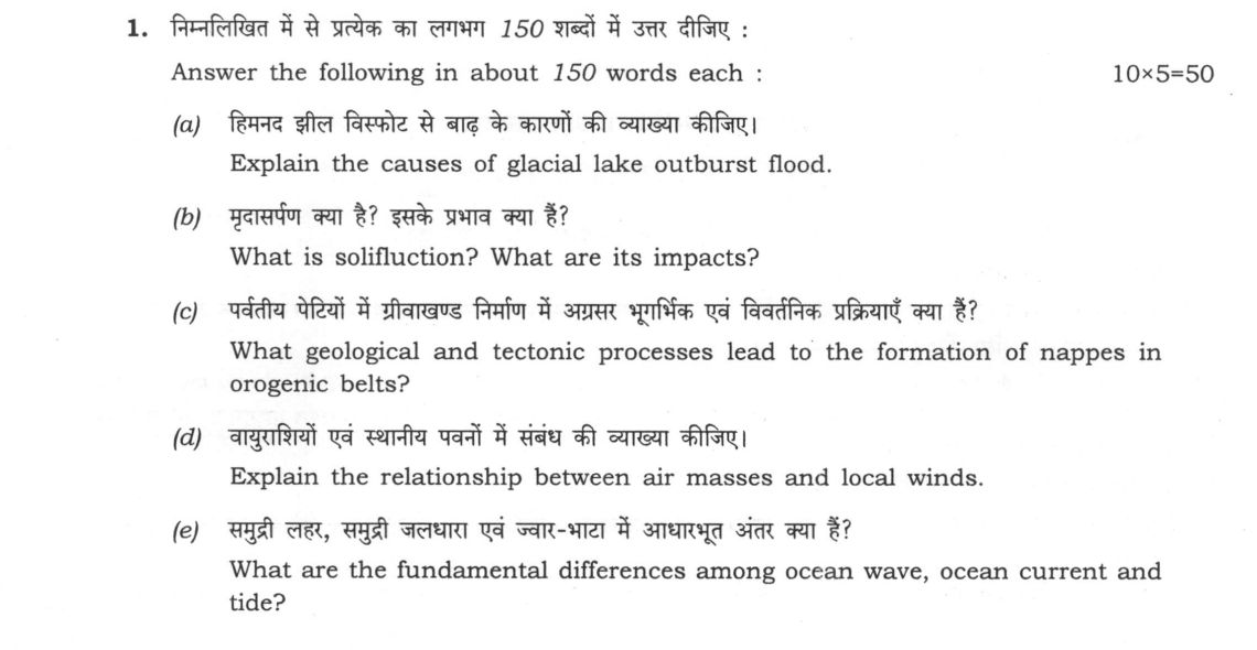
Answer the following in about 150 words each: (a) Explain the causes of glacial lake outburst flood. (10 marks) (b) What is…
Answer the following in about 150 words each:
Explain the causes of glacial lake outburst flood. 10 marks
What is solifluction? What are its impacts? 10 marks
What geological and tectonic processes lead to the formation of nappes in orogenic belts? 10 marks
Explain the relationship between air masses and local winds. 10 marks
What are the fundamental differences among ocean wave, ocean current and tide? 10 marks
हिंदी में प्रश्न पढ़ें
निम्नलिखित में से प्रत्येक का लगभग 150 शब्दों में उत्तर दीजिए :
हिमनद झील विस्फोट से बाढ़ के कारणों की व्याख्या कीजिए। (10 अंक)
मुदासरण क्या है? इसके प्रभाव क्या हैं? (10 अंक)
पर्वतीय पेटियों में प्रीवाखण्ड निर्माण में अपरद भूभिक एवं विवर्तनिक प्रक्रियाएँ क्या हैं? (10 अंक)
वायुराशियों एवं स्थानीय पवनों में संबंध की व्याख्या कीजिए। (10 अंक)
समुद्री लहर, समुद्री जलधारा एवं ज्वार-भाटा में आधारभूत अंतर क्या हैं? (10 अंक)
Model answer
Written by UPSC Answer Check against this question's marking rubric, to the 150-word length. UPSC does not publish answers for Mains — this is one way to score well, not an official key.
(a) GLOFs Glacial lake outburst floods (GLOFs) occur when water stored in moraine-dammed or ice-dammed lakes is released suddenly. The main cause is dam failure: as lakes grow, hydrostatic pressure weakens moraine; internal erosion or piping creates tunnels, while overtopping during heavy rain or glacial melt scours the dam. Seismic activity can crack moraines or trigger rock/ice avalanches into the lake, producing displacement waves. Ice avalanches and calving into ice-dammed lakes raise water levels rapidly. Climate warming intensifies these triggers by increasing glacial melt, lake expansion and debris supply; in the Himalayas, South Lhonak Lake in Sikkim is monitored because its moraine dam is growing and vulnerable. The 2013 Kedarnath floods, while multi-causal, showed how glacial melt, rainfall and riverine processes can combine into catastrophic downstream flooding. The breach can destroy bridges and villages downstream. Thus GLOFs are a chain: storage, trigger, dam breach, and high-velocity debris-laden outflow.
(b) Solifluction Solifluction is the slow, downslope creep of water-saturated soil or regolith over a frozen or impermeable permafrost table. In periglacial and alpine zones, summer thawing of the active layer increases pore-water pressure, while the underlying frozen ground prevents drainage. The saturated mass becomes plastic and flows under gravity, often as lobes or sheets. Repeated freeze-thaw cycles consolidate the material, producing terraced slopes, lobate deposits, and degraded hillside stability. Its impacts are practical as well as geomorphic: it blocks natural drainage, redirects streams, and increases landslide susceptibility. In Ladakh and Arunachal Pradesh, solifluction can undermine roads, bridges, and settlements on thawing slopes, especially where permafrost is disturbed by construction or warming. It also reduces agricultural land by burying or eroding fertile topsoil. Hence solifluction is not merely surface creep; it is a freeze-thaw-driven mass movement that reshapes cold-region landscapes and threatens infrastructure.
(c) Nappes Nappes form in orogenic belts where intense compressional tectonics cause extreme crustal shortening. When a thickened crust is squeezed, large rock masses detach along low-angle thrust faults and are transported over underlying strata. The process begins with folding; continued compression can produce recumbent folds, whose limbs flatten and break into thrust sheets. Gravity sliding assists movement, especially when weak layers such as shale, evaporite, or fault gouge act as detachment surfaces. In the Helvetic nappes of the Alps, large slices of Paleozoic and Mesozoic rock were thrust westward over younger cover. In the Himalaya, the Kumaon nappes show similar thrusting of crystalline and sedimentary sheets above the Main Central Thrust zone, though the MCT itself is a major thrust fault rather than a nappe. The result is a stacked, imbricate structure in which older rocks lie above younger ones, recording mountain-building by thrusting and gravitational collapse.
(d) Air masses and winds Air masses are large, uniform air bodies; local winds are pressure responses to their interaction with land, sea, and relief. When an air mass crosses a contrasting surface, it is thermally modified: maritime tropical (mT) air over heated land becomes unstable and fuels convectional winds, while continental tropical (cT) air over cooler water stabilizes. In India, monsoon reversal is driven mainly by differential heating and ITCZ migration, with cT air over the subcontinent and mT air over the Indian Ocean, not by continental polar air. Orographic channeling converts air-mass flow into local winds: Bora is a katabatic wind draining from elevated terrain, while Mistral is a pressure-gradient fall wind funneled through Rhône valley. Sea and land breezes arise when adjacent surfaces warm or cool an air mass, creating daily pressure cells. Thus air masses provide the thermal and moisture background, while local winds redistribute heat and moisture at smaller scales.
(e) Waves, currents, tides Ocean waves, currents, and tides differ in energy source, motion, and scale. Waves are oscillatory surface motions generated mainly by wind energy; water particles move in near-circular orbits, so waves transfer energy rather than large volumes of water. Ocean currents are sustained horizontal movements of water masses, driven by wind stress, density differences, and pressure gradients; they transport heat, salt, and nutrients. The southwest monsoon current in the Arabian Sea is a wind-driven seasonal current, whereas thermohaline circulation is density-driven and global. Tides are periodic vertical and horizontal water movements caused by gravitational pull of the Moon and Sun; they are predictable, rhythmic, and not dependent on wind. Their semidiurnal or diurnal periods are fixed by Earth-Moon-Sun geometry. Tidal ranges vary with basin shape, as in the Gulf of Khambhat, where funneling amplifies high tides. Thus waves are short-period oscillations, currents are mass transport, and tides are astronomical vertical pulsations.
What "Explain" is asking you to do
Make the working of something clear — what sets it off, what follows from what, and what it produces. Explain is the Commission's mechanism word: it dominates the technical papers and the “explain why” stems, where the marks sit in the causal chain and not in the label.
Structure that answers it
State what it is → the initiating condition → the chain of cause, step by step → an instance where it plays out → what the chain produces
Where marks are lost
Describing what something looks like instead of why it works that way. Naming the stages without linking them reads as description too.
How this answer will be evaluated
Approach
Framework: Concept or mechanism > Diagram > Regional example > Application. (a) explain: definition/context > points in order > small example > short close | (b) define: precise definition > the distinguishing feature > one example | (c) explain: definition/context > points in order > small example > short close | (d) explain: definition/context > points in order > small example > short close | (e) compare: paired headings or table > key differences > significance > conclusion Full marks: Clear causal chain, precise terminology, relevant examples, and diagrams where applicable.
Key points expected
- Formation of moraine-dammed lake
- Mechanism of dam failure (erosion/ice)
- Sudden release of stored water
- Downstream impact on valley
- Definition: downslope flow of saturated soil
- Role of permafrost/frost action
- Impact: formation of solifluction lobes
- Impact: soil erosion/landslide trigger
Evaluation rubric
Each sub-part is marked on its own, against the marks and word limit printed on the paper.
- (a) Causal chain of GLOF formation and release. · 150 words
explain— definition/context → points in order → small example → short close
Must cover
- Formation of moraine-dammed lake
- Mechanism of dam failure (erosion/ice)
- Sudden release of stored water
- Downstream impact on valley
Loses marks
- Describing general floods only
- No mention of glacial origin
Earns more
- Mention of ice-dammed vs moraine-dammed
- Reference to Himalayan context
- Diagram of dam failure
Extra mark
- Specific example (e.g., Chhota Shigri)
- Labelled sketch of GLOF
- (b) Definition of solifluction and its geomorphic impacts. · 150 words
define— precise definition → the distinguishing feature → one example
Must cover
- Definition: downslope flow of saturated soil
- Role of permafrost/frost action
- Impact: formation of solifluction lobes
- Impact: soil erosion/landslide trigger
Loses marks
- Confusing with general soil creep
- Ignoring the 'frozen' aspect
Earns more
- Mention of periglacial environment
- Distinction from creep
Extra mark
- Diagram of solifluction lobe
- Example from Ladakh/Alps
- (c) Geological and tectonic processes forming nappes. · 150 words
explain— definition/context → points in order → small example → short close
Must cover
- Compressional tectonic forces (convergence)
- Detachment along thrust/fault plane
- Overthrusting of rock sheets (nappes)
- Context of orogenic belt formation
Loses marks
- Describing folding without thrusting
- No mention of compressional stress
Earns more
- Mention of Alpine orogeny
- Distinction between nappes and folds
Extra mark
- Diagram of thrust faulting
- Specific example (e.g., Helvetian nappes)
- (d) Relationship between air masses and local winds. · 150 words
explain— definition/context → points in order → small example → short close
Must cover
- Air mass boundaries (fronts) create pressure gradients
- Local winds as manifestation of these gradients
- Modification of air mass by local terrain
- Example: Monsoon as air mass interaction
Loses marks
- Describing winds without air mass context
- Ignoring the pressure gradient link
Earns more
- Mention of specific air mass types (cP, mT)
- Link to local wind names (Loo, Mistral)
Extra mark
- Diagram of air mass interaction
- Specific local wind example
- (e) Fundamental differences among wave, current, and tide. · 150 words
compare— paired headings or table → key differences → significance → conclusion
Must cover
- Wave: oscillatory motion, wind-driven
- Current: horizontal flow, wind/pressure driven
- Tide: vertical/horizontal, gravitational (moon/sun)
- Comparison of driving forces and motion
Loses marks
- Confusing tides with waves
- No mention of driving forces
Earns more
- Mention of Coriolis effect on currents
- Distinction between surface and deep currents
Extra mark
- Table comparing the three
- Specific example (e.g., Gulf Stream)
Practice this exact question
Write your answer and it is marked point by point against the model answer above — what you covered, what you missed, what you got wrong.
Evaluate my answer →More from Geography 2025 Paper I
- Q1 Answer the following in about 150 words each: (a) Explain the causes of glacial lake outb…
- Q2 (a) How does denudation chronology help in understanding the sequential development of la…
- Q3 (a) Examine the formation of atmospheric tricellular circulation system. Describe with ex…
- Q4 (a) What are the ecological consequences of agricultural deforestation in the Amazon and…