Paper II — Q7
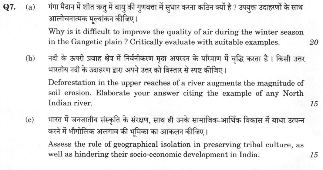
(a) Why is it difficult to improve the quality of air during the winter season in the Gangetic plain ? Critically evaluate with…
Why is it difficult to improve the quality of air during the winter season in the Gangetic plain ? Critically evaluate with suitable examples. 20 marks
Deforestation in the upper reaches of a river augments the magnitude of soil erosion. Elaborate your answer citing the example of any North Indian river. 15 marks
Assess the role of geographical isolation in preserving tribal culture, as well as hindering their socio-economic development in India. 15 marks
हिंदी में प्रश्न पढ़ें
गंगा मैदान में शीत ऋतु में वायु की गुणवत्ता में सुधार करना कठिन क्यों है ? उपयुक्त उदाहरणों के साथ आलोचनात्मक मूल्यांकन कीजिए । (20 अंक)
नदी के ऊपरी प्रवाह क्षेत्र में विनिर्वनीकरण मृदा अपरदन के परिमाण में वृद्धि करता है । किसी उत्तर भारतीय नदी के उदाहरण द्वारा अपने उत्तर को विस्तार से स्पष्ट कीजिए । (15 अंक)
भारत में जनजातीय संस्कृति के संरक्षण, साथ ही उनके सामाजिक-आर्थिक विकास में बाधा उत्पन्न करने में भौगोलिक अलगाव की भूमिका का आकलन कीजिए । (15 अंक)
Model answer
Drafted with AI by UPSC Answer Check against this question's marking rubric, to the expected length. UPSC does not publish answers for Mains — this is one way to score well, not an official key. How we build rubrics and answers.
(a) Why winter air quality is hard to improve in the Gangetic plain
The difficulty in improving winter air quality in the Gangetic plain stems from a unique convergence of topographic, meteorological, and chemical factors that create a "pollution trap." Topographically, the Indo-Gangetic Plain is a vast bowl bounded by the Himalaya to the north and the Aravalli and Vindhyan uplands to the south-west and south, with weak winter winds blowing down its axis, which restricts the lateral dispersion of pollutants. Meteorologically, winter brings temperature inversions and a collapsed mixing height, effectively capping the atmosphere and preventing vertical dispersion. This leads to the accumulation of secondary inorganic aerosols (sulphate, nitrate, and ammonium) which react with moisture to form fog-haze, further reducing visibility and solar radiation.
The source mix is diverse and persistent. While paddy stubble burning in Punjab and Haryana is a major short-duration contributor — worsened because the Punjab Preservation of Subsoil Water Act, 2009 pushed transplanting later and so compressed the harvest-to-sowing window — it is superimposed on a high baseline of residential biomass burning, transport emissions, and industrial activity. The governance mismatch is a critical failure point; pollution is an airshed phenomenon, yet regulation is state-fragmented. The Commission for Air Quality Management (CAQM, statutory since 2021) covers only the NCR and adjoining areas, the Graded Response Action Plan (GRAP, 2017, revised 2022) is largely reactive, triggering only after the Air Quality Index (AQI) has already deteriorated, and the National Clean Air Programme (2019), targeting a 40 per cent cut in particulate levels by 2025-26 in 131 non-attainment cities, is non-statutory and city-centric, while cities such as Kanpur, Lucknow, Patna and Muzaffarpur have thin monitoring.
Critically, emergency measures have shown low efficacy. Odd-even rationing and construction halts impose economic costs without altering the seasonal baseline. Smog towers and anti-smog guns suppress coarse dust but fail to address the fine secondary aerosols that dominate winter PM2.5. Furthermore, the Pusa bio-decomposer’s efficacy is contested, and the Happy Seeder is limited by the short turnaround between paddy harvest and wheat sowing. With the ICMR-Lancet estimating 1.67 million air-pollution-attributable deaths in India in 2019, the current "winter ritual" of emergency measures is insufficient. A shift toward airshed-level management, crop diversification, and clean household energy is essential.
(b) Upper-catchment deforestation and soil erosion: the Kosi
Deforestation in upper river reaches disrupts the natural hydrological cycle, significantly augmenting soil erosion. The removal of the forest canopy eliminates interception, while the loss of litter cover and root cohesion reduces the soil's infiltration capacity. This leads to a higher runoff coefficient and a shorter time of concentration, resulting in increased peak discharge. The erosional process follows a sequence from splash and sheet erosion to rill and gully erosion, and eventually to shallow landsliding as root decay destabilizes slopes.
The Kosi river serves as a compelling example of this dynamic. With a catchment area of approximately 74,500 sq km, the Kosi carries one of the world's highest sediment loads. The degradation of the catchment has led to severe aggradation and braiding, causing the river to migrate westward by about 115 km over two centuries. The construction of the Kosi barrage at Bhimnagar on the Nepal side in 1963 and the subsequent embankments were attempts to control this, yet the Kusaha breach in August 2008 highlighted the persistent vulnerability. Similarly, the Alaknanda flood of 1970, whose devastation in a heavily logged catchment helped catalyse the Chipko movement (Mandal, 1973; Reni, 1974), and siltation of the Ramganga (Kalagarh) and Tehri reservoirs show the same link.
While Ives and Messerli’s critique (The Himalayan Dilemma, 1989) suggests that tectonic uplift and seismicity also dominate basin-scale sediment production, deforestation remains a primary hillslope-scale control. Management responses include catchment area treatment plans, the establishment of van panchayats, and the construction of check dams and contour trenches. However, without sustained Indo-Nepal cooperation on catchment treatment (the long-discussed Sapta Kosi high dam remains unrealised), the sediment load will continue to threaten the river's stability and the reservoirs it feeds.
(c) Geographical isolation and India's tribal communities
India's 10.43 crore Scheduled Tribes (8.6 per cent of the population, 705 notified tribes including 75 PVTGs, Census 2011) live largely in hill, forest and island refuge areas of the central belt, the North-East and the Andaman and Nicobar Islands. Geographical isolation has played a dual role in their trajectory, acting as both a shield for cultural preservation and a barrier to socio-economic development. On one hand, the remoteness of regions like the Andaman Islands or the dense forests of the Northeast has allowed for the preservation of unique cultural identities. For instance, the Sentinelese remain in a state of near-total isolation, and tribes like the Santhal have maintained their Ol Chiki script (Santali entered the Eighth Schedule in 2003) and traditional social structures, and sacred groves such as the sarna of Jharkhand and the law kyntang of Meghalaya survive. In the Northeast, the Sixth Schedule provides a degree of administrative autonomy that helps protect tribal lands and customs from external encroachment.
On the other hand, this isolation has significantly hindered socio-economic progress. The lack of physical connectivity results in poor access to essential services such as healthcare and education. Consequently, tribal literacy (about 59 per cent in 2011) remains well below the national 73 per cent, and many communities, particularly the Particularly Vulnerable Tribal Groups (PVTGs), face high mortality rates and malnutrition. The historical debate between Elwin’s "protectionist" approach and Ghurye’s "assimilationist" view led to the adoption of Nehru’s Panchsheel, which sought to integrate tribes without destroying their identity.
Yet ending isolation brings its own harm: the mineral-rich tracts isolation once protected are where mining, dams and roads have displaced tribal households far out of proportion to their numbers (contested in the Samatha, 1997, and Niyamgiri, 2013, cases), and remoteness has also let left-wing extremism entrench itself. Modern frameworks like PESA (1996), the Forest Rights Act (2006), the Xaxa Committee (2014) recommendations, Eklavya Model Residential Schools and PM-JANMAN (2023) for PVTGs aim to empower these communities, yet geographical barriers continue to impede their implementation. The assessment suggests that while isolation has preserved the cultural fabric of tribal India, it has also created a development deficit. The path forward requires a balanced approach that develops these regions on tribal terms, ensuring that connectivity and economic integration do not come at the cost of cultural erasure.
How this answer will be evaluated
Evaluation rubric
Each sub-part is marked on its own, against the marks and word limit printed on the paper.
- (a) Explain why winter air-quality improvement is so hard specifically in the Gangetic plain - i.e. the meteorological trap, the winter chemistry, the diverse source mix and the governance mismatch - and then critically evaluate, with named examples, why the measures actually tried have not worked. 20 marks
Must cover
- temperature inversion and collapsed mixing height / ventilation coefficient
- Indo-Gangetic Plain as a topographic bowl bounded by the Himalaya
- secondary inorganic aerosol (sulphate, nitrate, ammonium) and the fog-haze radiative feedback
- paddy stubble burning; Punjab Preservation of Subsoil Water Act, 2009 and the delayed transplanting window
- residential biomass burning for cooking and heating
- Commission for Air Quality Management (statutory, 2021)
- Graded Response Action Plan (2017, revised 2022)
- National Clean Air Programme (2019) and the 131 non-attainment cities
- smog towers, odd-even, anti-smog guns as low-efficacy measures
- Happy Seeder / Super Seeder; Pusa bio-decomposer
- ICMR-Lancet estimate of about 1.67 million air-pollution-attributable deaths in India in 2019
- airshed-level rather than city-level management
Loses marks
- Blaming stubble burning alone; it is a short-duration contributor superimposed on a high winter baseline dominated by biomass, transport, industry and secondary aerosol.
- Listing sources of pollution without explaining the winter meteorology, which is the actual reason the question asks 'why in winter'.
- No critical evaluation of measures - the question says 'critically evaluate with suitable examples', so smog towers, odd-even and GRAP must be assessed, not merely listed.
- Confining the answer to Delhi and ignoring Kanpur, Lucknow, Patna, Muzaffarpur and the plain as a whole.
- Confusing the mixing height with the tropopause, or asserting that fog is caused by pollution alone rather than being a mutually reinforcing process.
Earns more
- The governance mismatch: pollution is an airshed phenomenon spanning Punjab, Haryana, Delhi, Uttar Pradesh, Bihar and Rajasthan, while regulation is state-fragmented and city-centric. The Commission for Air Quality Management in the National Capital Region and Adjoining Areas, statutory since 2021, governs only the NCR airshed and not the wider plain; the Graded Response Action Plan (2017, revised in 2022) is reactive and triggers only after the AQI has already deteriorated; the National Clean Air Programme (2019) is a non-statutory target framework (originally a 20-30 percent reduction by 2024 against a 2017 base, revised to 40 percent by 2025-26 for 131 non-attainment cities) implemented through city action plans of uneven quality and largely PM10-focused; and continuous monitoring is dense in Delhi but thin across the rest of the plain, so source apportionment outside the capital is weak.
- Critical evaluation of what has actually been tried, with examples: emergency measures - odd-even rationing, construction halts, school closures, restrictions on truck entry - buy a few days and impose economic cost without changing the seasonal baseline; the smog towers at Connaught Place and Anand Vihar produced no measurable area-wide benefit; anti-smog guns and water sprinkling suppress coarse road dust but not the fine secondary aerosol that dominates winter PM2.5; the Pusa bio-decomposer's field efficacy remains contested; Happy Seeder and Super Seeder adoption is limited by machine cost, custom-hiring availability and the very short turnaround between paddy harvest and wheat sowing; Ujjwala connections without affordable refills leave households back on biomass; and the political economy of assured paddy procurement and free farm power sustains the very cropping system that generates the residue.
- Burden and direction: cities of the plain - Delhi, Ghaziabad, Noida, Kanpur, Lucknow, Patna, Muzaffarpur, Begusarai - recur among the world's most polluted; the ICMR-Lancet state-level disease burden work attributed of the order of 1.67 million deaths in India in 2019 to air pollution, roughly 18 percent of all deaths, with an economic loss of about 1.4 percent of GDP. The workable direction is an airshed-level, legally binding, source-apportionment-driven and year-round programme - clean household energy, crop diversification away from paddy and residue-to-energy markets, flue-gas desulphurisation enforcement, electrified freight and public transport, dense monitoring - rather than a winter emergency ritual.
- (b) Elaborate the causal chain from upper-catchment deforestation to increased soil erosion, and then anchor it in a named North Indian river. The example is compulsory - a general answer without one named river and its documented sediment or channel behaviour is incomplete. 15 marks
Must cover
- interception, litter cover, root cohesion, infiltration capacity
- splash - sheet - rill - gully erosion sequence; delayed shallow landsliding after root decay
- runoff coefficient, time of concentration, peak discharge
- aggradation, braiding, avulsion, reservoir siltation
- Kosi - catchment of about 74,500 sq km; among the world's highest sediment loads
- westward migration of the Kosi of about 115 km in roughly two centuries
- Kosi barrage at Bhimnagar (1963) and embankments; the Kusaha breach of August 2008
- Alaknanda flood of 1970 and the Chipko movement (Mandal 1973, Reni 1974)
- catchment area treatment plans; van panchayats; check dams and contour trenching
- Ives and Messerli's critique of the Himalayan degradation narrative (debated)
Loses marks
- Not naming a North Indian river, or naming one without any specific data, event or channel behaviour - the question makes the example compulsory.
- Describing erosion types in the abstract without the hydrological mechanism (interception, infiltration, root cohesion) that links deforestation to erosion.
- Stopping at the hillslope and never showing the downstream consequences of the sediment - aggradation, avulsion, reservoir siltation.
- Asserting that deforestation alone causes Himalayan floods, ignoring tectonics, seismicity and cloudbursts; conversely, dismissing the deforestation link entirely.
- Getting the case wrong - placing the Kosi barrage in India when Bhimnagar-Hanuman Nagar lies on the Nepal side, or dating the Kusaha breach to a year other than 2008.
Earns more
- Corroborating cases and the scholarly caveat that makes the answer 'elaborated' rather than asserted: the Alaknanda flood of 1970, whose devastation in a heavily logged catchment helped trigger the Chipko movement (Mandal, 1973; Reni under Gaura Devi, 26 March 1974); siltation shortening the useful life of the Ramganga (Kalagarh) and Tehri reservoirs; sediment loading of the Yamuna from its Shivalik and Doon catchment. Against this must be set the critique of the simple 'Himalayan degradation' narrative by Ives and Messerli (The Himalayan Dilemma, 1989) and later sediment-budget work indicating that tectonic uplift, seismicity and extreme rainfall events dominate basin-scale sediment production, so deforestation augments erosion at the hillslope scale without being the sole basin-scale control - a point best stated as a debated qualification, not a refutation.
- Management response upstream: catchment area treatment plans made mandatory for hydro and irrigation projects; afforestation with mixed native species and slope bioengineering; contour trenching, staggered trenches, check dams and gully plugging; regulation of hill-road muck disposal; community forest institutions - Uttarakhand's van panchayats and joint forest management - and watershed development under the Watershed Development Component of PMKSY; and, for the Kosi specifically, Indo-Nepal cooperation on catchment treatment and the long-discussed high dam, which remains unrealised.
- (c) Assess the dual role of geographical isolation for India's tribal communities - how it has preserved their culture AND how it has hindered their socio-economic development. Both halves must be argued with named tribes, regions, data and institutions, and an assessment (a judgement) offered at the end. 15 marks
Must cover
- 10.43 crore Scheduled Tribes, 8.6 percent of population; 705 tribes; 75 PVTGs (Census 2011)
- Sixth Schedule; Articles 244, 371A and 371G
- sacred groves - sarna, law kyntang, devrai; dorbar shnong, nokma
- Santali in Ol Chiki and Bodo in the Eighth Schedule (92nd Amendment, 2003)
- ST literacy of about 59 percent against roughly 73 percent nationally (Census 2011)
- PESA, 1996 and the Forest Rights Act, 2006 (individual and community forest rights)
- Xaxa Committee (2014)
- Verrier Elwin, G. S. Ghurye, Nehru's Tribal Panchsheel (1958)
- displacement and land alienation; Samatha judgment (1997); Niyamgiri (2013)
- Eklavya Model Residential Schools; Van Dhan Vikas Kendras; PM-JANMAN (2023)
- Sentinelese, Shompen, Jarawa as isolation extremes; National Sickle Cell Anaemia Elimination Mission (2023)
Loses marks
- Treating only one half of the question - usually the developmental handicaps - when 'as well as' makes both halves compulsory.
- Writing about tribes in general with no named tribe, region, statute or figure, which makes the assessment unverifiable.
- Romanticising isolation as wholly benign, or conversely presenting tribal culture as something to be assimilated away - the examiner expects the integrationist middle position.
- Confusing the Fifth Schedule (Scheduled Areas in mainland states) with the Sixth Schedule (autonomous district councils in Assam, Meghalaya, Tripura and Mizoram).
- Attributing community forest rights to PESA alone; individual and community forest rights come from the Forest Rights Act of 2006.
Earns more
- Fixes the geography: 10.43 crore Scheduled Tribes, about 8.6 percent of India's population, across 705 notified tribes including 75 particularly vulnerable tribal groups (Census 2011); concentrated in the central Indian belt (Jharkhand, Odisha, Chhattisgarh, Madhya Pradesh, Maharashtra), the North-East where Mizoram, Nagaland and Meghalaya each have over 85 percent tribal population, the western belt of Gujarat and Rajasthan, isolated southern pockets such as the Nilgiris (Toda, Kota, Kurumba, Irula), and the Andaman and Nicobar Islands - overwhelmingly hill, forest and island tracts that acted as refuge areas.
- The paradox that ending isolation brings its own harm: the mineral-rich, forested tracts that isolation protected are precisely where mining, dams, industry and roads have displaced tribal households in numbers far out of proportion to their population share, with land alienation continuing despite Fifth Schedule safeguards - the Samatha judgment (1997) on tribal land in Scheduled Areas and the Niyamgiri gram sabha consultation (2013) mark the contest; exposure has brought indebtedness, alcoholism, language loss and the commodification of culture (the 'human safari' controversy along the Andaman Trunk Road adjoining Jarawa areas); uncontacted groups face epidemic risk; and the same remoteness has allowed left-wing extremism to entrench itself in the central belt. Neither isolation nor forced integration is therefore a solution.
- The doctrinal debate and the policy framework, ending in an assessment: Verrier Elwin's protectionist 'national park' position against G. S. Ghurye's assimilationist view of tribals as 'backward Hindus', resolved in Nehru's Tribal Panchsheel (1958) of integration without imposition; the Fifth and Sixth Schedules under Article 244, PESA (1996) giving gram sabhas control over minor forest produce, minor minerals and land alienation in Scheduled Areas, and the Forest Rights Act (2006) recognising individual and community forest rights; the Xaxa Committee report (2014) on tribal socio-economic, health and educational status; Eklavya Model Residential Schools, Van Dhan Vikas Kendras and minimum support price for minor forest produce through TRIFED; PM-JANMAN (2023) for particularly vulnerable tribal groups and the Dharti Aaba tribal village programme; and the National Commission for Scheduled Tribes under Article 338A. Assessment: isolation preserved identity at the price of capability, and the way out is development on tribal terms - community rights, self-governance and culturally appropriate services - rather than either sealing off or absorbing.
What "Critically evaluate" is asking you to do
Judge how well something has performed against the standard it set for itself — its stated aim, mandate or promise — and commit to a verdict. Name the yardstick before you judge; an unanchored judgement reads as opinion. “Critically” is not a section added at the end: name the yardstick you are judging by — the evidence, the stated objective, a constitutional principle, a rival explanation — and let a verdict close each part of the body. Where the question quotes a claim, that verdict must land on the claim itself, accepted, qualified or rejected, and not on the theme in general.
Structure that answers it
Name the yardstick — stated aim, mandate or benchmark → performance against it → shortfall against it → why the gap exists → verdict
Where marks are lost
Merits in one paragraph, demerits in the next, and a conclusion calling for a balanced and holistic approach. That is a survey with the judgement left out and it holds the answer in the middle band. The opposite error is reading “critically” as permission to attack — and with the odd pairings, critically describe or critically explain, the exposition still carries most of the marks, the judgement being a layer on it rather than a substitute for it.
Practice this exact question
Write your answer and it is marked point by point against the model answer above — what you covered, what you missed, what you got wrong.
Evaluate my answer →More from Geography 2026 Paper II
- Q4 (a) Analyse the spatial distribution of India's automobile industry. How have the cluster…
- Q5 (a) Analyse the consequences of circular migration in India. How does it influence both r…
- Q6 (a) Examine the trends in fertility rates across Indian states over time. How are they pr…
- Q7 (a) Why is it difficult to improve the quality of air during the winter season in the Gan…
- Q8 (a) Critically examine the strategic, economic and ecological impacts of the proposed ‘Gr…