Paper II — Q6
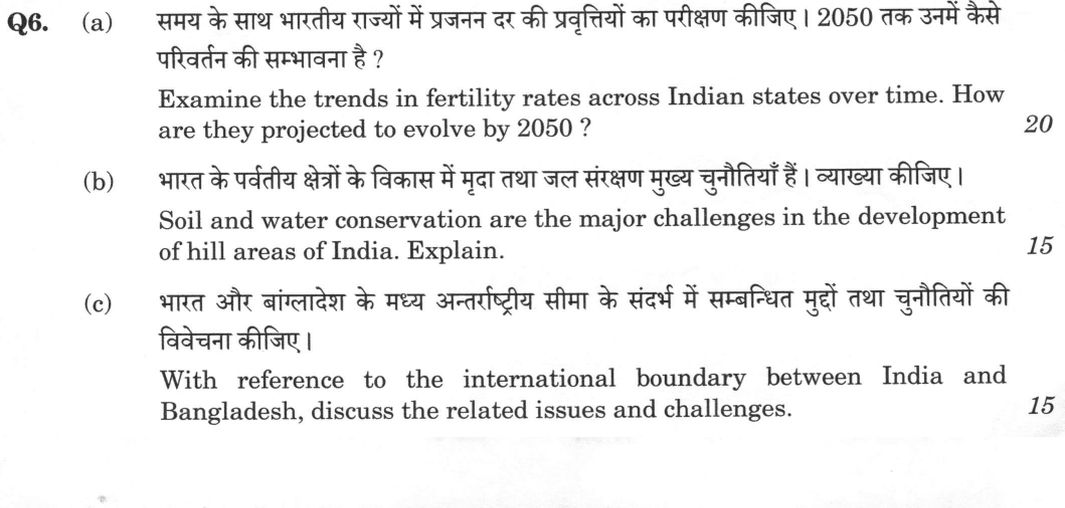
(a) Examine the trends in fertility rates across Indian states over time. How are they projected to evolve by 2050 ? (20…
Examine the trends in fertility rates across Indian states over time. How are they projected to evolve by 2050 ? 20 marks
Soil and water conservation are the major challenges in the development of hill areas of India. Explain. 15 marks
With reference to the international boundary between India and Bangladesh, discuss the related issues and challenges. 15 marks
हिंदी में प्रश्न पढ़ें
समय के साथ भारतीय राज्यों में प्रजनन दर की प्रवृत्तियों का परीक्षण कीजिए । 2050 तक उनमें कैसे परिवर्तन की सम्भावना है ? (20 अंक)
भारत के पर्वतीय क्षेत्रों के विकास में मृदा तथा जल संरक्षण मुख्य चुनौतियाँ हैं । व्याख्या कीजिए । (15 अंक)
भारत और बांग्लादेश के मध्य अन्तर्राष्ट्रीय सीमा के संदर्भ में सम्बन्धित मुद्दों तथा चुनौतियों की विवेचना कीजिए । (15 अंक)
Model answer
Drafted with AI by UPSC Answer Check against this question's marking rubric, to the expected length. UPSC does not publish answers for Mains — this is one way to score well, not an official key. How we build rubrics and answers.
(a) Fertility trends across Indian states and the outlook to 2050
India’s fertility rates have undergone a significant decline, transitioning from a high-growth phase to near-replacement levels, though marked inter-state differentials persist. According to the National Family Health Surveys (NFHS), the national Total Fertility Rate (TFR) dropped from 3.4 in NFHS-1 (1992-93) to 2.7 in NFHS-3 (2005-06) and 2.2 in NFHS-4 (2015-16), reaching 2.0 in NFHS-5 (2019-21), a level the Sample Registration System also reports. This national average masks a spatial divergence: while states like Sikkim (1.1) and Kerala (1.8) are well below the replacement level of 2.1, five states remain above it: Bihar (3.0), Meghalaya (2.9), Uttar Pradesh (2.4), Jharkhand (2.3), and Manipur (2.2). These variations are explained by Notestein’s demographic transition theory, with states at different points of its third stage, and Caldwell’s wealth-flows thesis: higher female literacy and age at marriage, lower child mortality, wider contraceptive use (about 67 per cent of couples at NFHS-5), urbanisation and health-system reach in the south have accelerated the transition.
Projections for 2050 indicate a continued decline toward sub-replacement levels across all states. The Technical Group on Population Projections (2019) estimates the population will reach approximately 152 crore by 2036, while the UN World Population Prospects (2024) suggests a peak in the early 2060s, and the IHME–Lancet (2024) study projects national TFR falling to about 1.3 by 2050; projections differ mainly on how fast the north-central states converge. By 2050, the demographic landscape will see the south and west ageing rapidly, with Kerala projected to have more than a fifth (about 23 per cent) of its population aged 60 and above by 2036 (India Ageing Report 2023). Conversely, the north-centre (Bihar, UP, Jharkhand) will continue to supply the bulk of the population increment. This divergence will intensify internal migration and create political tensions regarding the delimitation freeze and Finance Commission devolution (states' share held at 41 per cent by the Sixteenth Finance Commission), as states that reduced fertility fastest may feel penalised. Consequently, the policy focus must shift from fertility limitation to managing the closing demographic dividend window (around the early 2040s) and rising old-age dependency.
(b) Soil and water conservation in India's hill areas
Soil and water conservation are the primary challenges in the development of India’s hill areas due to the region's fragile physical geography and the pressures of modern development. The Himalaya, Western Ghats, and North-Eastern hills are characterised by steep relief, thin immature soils, and high seismicity (Zones IV and V). In the Himalaya, the young, tectonically active geology makes the terrain lithologically fragile. According to the Geological Survey of India, roughly 12-13 percent of India’s land area is landslide-prone. This is exacerbated by erratic monsoon rainfall and cloudbursts, leading to sheet, rill, and gully erosion.
The challenge is compounded by human activities. The shortening of the jhum (shifting cultivation) cycle in the North-East, along with the expansion of roads, hydropower, and tourism, has destabilised slopes. Recent disasters, such as the Kedarnath floods (2013), the Chamoli rock-and-ice avalanche and flood (2021), the Joshimath subsidence (2023) and the Wayanad landslides (2024), highlight the severity of these risks. Water conservation is equally critical; the NITI Aayog report (2018) noted that nearly half of the perennial springs of the Indian Himalayan Region have dried up or turned seasonal, though about 60 per cent of its people depend on spring water, while glacial lake outburst floods (GLOFs), like the South Lhonak Lake event in Sikkim (2023), pose a growing threat.
Conservation measures include bench terracing, contour bunding, and check dams. Traditional systems like the kuhl/gul in Himachal Pradesh, naula/dhara in Uttarakhand, and bamboo-drip irrigation, zabo (Nagaland) and Apatani wet-rice farming (Arunachal Pradesh) in the North-East are being revived, alongside the Watershed Development Component of PMKSY and the National Mission for Sustaining the Himalayan Ecosystem. State and community initiatives such as Sikkim’s Dhara Vikas springshed programme, Uttarakhand's van panchayats (since 1931) and the legacy of the Chipko movement, and Sukhomajri's watershed management in the Shivaliks demonstrate community-led success. However, the challenge persists because of the "development gap": conservation investment is often unremunerative for small, fragmented holdings, and ecologically sensitive area notifications (Gadgil 2011, Kasturirangan 2013) remain largely unimplemented.
(c) The India–Bangladesh boundary: issues and challenges
The international boundary between India and Bangladesh, spanning 4,096.7 km, is India’s longest land border, touching West Bengal, Tripura, Meghalaya, Mizoram, and Assam. Its management involves complex legal-historical evolution, physical demarcation difficulties, and security challenges. Historically, the border was shaped by the Radcliffe Line (1947), the Bagge Award (1950), the Nehru-Noon Agreement (1958) and the Land Boundary Agreement (1974). A major milestone was the 100th Constitutional Amendment Act (2015), which implemented the exchange of 111 Indian enclaves (chhitmahals) in Bangladesh and 51 Bangladeshi enclaves in India, though former enclave residents still face land-record and service-delivery problems; Dahagram-Angarpota stays with Bangladesh, linked through the Tin Bigha corridor, open round the clock since 2011.
Physical management is difficult due to the riverine nature of the border, where shifting chars (river islands) create ambiguity. The 1975 joint guidelines established a "150-yard rule" for patrolling, but incomplete fencing and friction between the BSF and BGB remain issues. Security challenges include illegal migration, which is addressed through the Assam Accord (1985) with its 25 March 1971 cut-off, Section 6A of the Citizenship Act (upheld by the Supreme Court in 2024) and the NRC (2019), as well as the smuggling of cattle, phensedyl/yaba, and fake currency. Human trafficking and the Felani Khatun case (2011) further highlight the human rights dimensions of border management.
Despite these challenges, the border is a site of significant cooperation. The Coordinated Border Management Plan (2011) and border haats have fostered trade. Connectivity has improved through the Petrapole-Benapole and Agartala-Akhaura land ports, the Maitri Setu (2021), and the Akhaura-Agartala rail link (2023). Water-sharing across 54 shared rivers remains a key diplomatic area, with the Ganga Waters Treaty (1996), due for renewal in 2026, and the Kushiyara MoU (2022) providing frameworks, although the Teesta river impasse persists; the political transition in Dhaka since August 2024 has added uncertainty over fencing, border management and connectivity projects. The 2014 Permanent Court of Arbitration award also settled the maritime boundary in the Bay of Bengal, providing a legal basis for future resource management.
How this answer will be evaluated
Evaluation rubric
Each sub-part is marked on its own, against the marks and word limit printed on the paper.
- (a) Two explicit tasks: examine the trend of fertility rates across Indian states over time (the national decline plus the inter-state differential, with figures), and then state how fertility is projected to evolve by 2050, with the sources and the uncertainty in those projections. Consequences should be indicated but the core is trend plus projection. 20 marks
Must cover
- total fertility rate and replacement level of 2.1
- NFHS-5 (2019-21) national TFR 2.0; NFHS-4 2.2; NFHS-3 2.7; NFHS-1 3.4
- the five states above replacement at NFHS-5: Bihar 3.0, Meghalaya 2.9, Uttar Pradesh 2.4, Jharkhand 2.3, Manipur 2.2
- Sikkim lowest at 1.1; Kerala and Tamil Nadu about 1.8
- Sample Registration System
- contraceptive prevalence and unmet need (NFHS-5)
- Technical Group on Population Projections (2019) - about 152 crore by 2036
- UN World Population Prospects - India most populous from 2023, peak around the early 2060s
- IHME/Lancet 2024 projection of a much lower TFR by 2050
- demographic transition theory (Notestein); Caldwell's wealth flows
- ageing, demographic dividend window, delimitation freeze and Finance Commission devolution
Loses marks
- Giving no numbers at all, or quoting obsolete ones (for example an all-India TFR of 2.5 or 'Kerala 1.7' when NFHS-5 reports 1.8) - this is a data question and wrong data is heavily penalised.
- Answering only the trend and omitting the projection to 2050, which is an explicit second question.
- Confusing the total fertility rate with the crude birth rate, the general fertility rate or the growth rate.
- Claiming India's population will start falling before mid-century; the population continues to grow through momentum despite sub-replacement fertility, peaking only around the 2060s.
- Treating all southern states or all northern states as homogeneous, when Meghalaya and Manipur are high-fertility and Sikkim, Goa and West Bengal are among the lowest.
Earns more
- Explains the differentials: female literacy, years of schooling and age at marriage; infant and child mortality as the driver of desired family size; contraceptive prevalence (about 67 percent of couples using any method and 56 percent modern methods at NFHS-5) and the fall in unmet need; women's work participation, autonomy and land rights; urbanisation and the rising cost of raising children; health-system reach; and the contrast between Kerala's and Tamil Nadu's social-development route and the more programme- and sterilisation-driven route elsewhere. Theory should be named - Notestein's demographic transition model (states are at different stages of the third stage), Caldwell's intergenerational wealth-flows thesis, and Bongaarts' proximate determinants.
- Spatial picture by mid-century: near-universal sub-replacement fertility, with the south and west far below it and ageing fastest (Kerala already has the highest share of persons aged 60 and above and is projected to exceed a fifth - about 23 percent - by 2036 in the India Ageing Report 2023); Bihar, Uttar Pradesh, Jharkhand, Madhya Pradesh and Rajasthan converging last and therefore supplying most of the national population increment and the bulk of new labour-force entrants; hence widening demographic divergence between a young north-centre and an ageing south.
- Consequences to flag: the demographic dividend window closing around the early 2040s as the working-age share peaks; rising old-age dependency, pension and long-term-care costs, especially in the south; intensified south-bound and metropolitan internal migration with attendant language and identity politics; and the political economy of the freeze on Lok Sabha seat allocation and of Finance Commission devolution, where states that reduced fertility fastest fear being penalised - which is why the policy agenda must shift from fertility limitation to ageing, care, labour mobility and quality of human capital.
- (b) Explain - give reasons and evidence for - the proposition that soil and water conservation are the major challenges in developing India's hill areas. Both soil and water must be treated, with the physical and human causes, the measures attempted, and why the challenge persists. 15 marks
Must cover
- seismic zones IV and V; young, tectonically active Himalaya; landslide-prone share of India's area
- jhum cycle shortening in the North-East
- Joshimath subsidence (2023); Kedarnath (2013); Chamoli (2021); Wayanad (2024)
- NITI Aayog report on Himalayan springs (2018) - drying perennial springs
- South Lhonak Lake glacial lake outburst flood, Sikkim (2023)
- bench terracing, contour bunding, check dams, gully plugging, agroforestry
- springshed management - Sikkim's Dhara Vikas
- Watershed Development Component of PMKSY
- traditional systems: kuhl/gul, naula/dhara, zabo, bamboo-drip irrigation, Apatani wet-rice
- van panchayats of Uttarakhand; Sukhomajri; Chipko movement
- National Mission for Sustaining the Himalayan Ecosystem
- Gadgil (2011) and Kasturirangan (2013) reports on the Western Ghats
Loses marks
- Writing only about soil erosion and neglecting water, or vice versa - the question names both.
- Listing generic conservation measures (afforestation, terracing) with no named programme, state initiative or traditional system.
- Treating hill areas as if they were only the Himalaya, ignoring the Western Ghats, the Nilgiris and the North-Eastern hills.
- Blaming shifting cultivation alone while ignoring roads, hydropower, quarrying and tourism, which are now the larger drivers.
- Giving no dated example of a hill disaster, so the argument about severity remains assertion.
Earns more
- The physical setting: India's hill regions - the Western and Eastern Himalaya, the North-Eastern hills, the Western and Eastern Ghats, the Nilgiris, the Aravalli and the Satpura-Maikal ranges - are steep, and in the Himalaya young, tectonically active and lithologically fragile, lying largely in seismic zones IV and V; high relief energy, thin immature soils and intense, increasingly erratic monsoon rainfall with cloudbursts make sheet, rill, gully and landslide erosion inherent; on Geological Survey of India mapping roughly 12-13 percent of India's land area is landslide-prone.
- Why the challenge persists - the development and governance gap: tiny, fragmented, terraced holdings on which conservation investment is unremunerative; out-migration and 'ghost villages' in Uttarakhand; the revenue pull of tourism, hydropower and road building against conservation; Western Ghats ecologically sensitive area notifications still unimplemented after the Gadgil (2011) and Kasturirangan (2013) reports; absence of carrying-capacity-based planning and weak enforcement of hill building bye-laws; and the Himalayan states' demand for a 'green bonus' compensating them for the ecosystem services they protect.
- (c) Discuss, with reference to the India-Bangladesh international boundary, the issues and challenges connected with it - the legal-historical evolution, the physical difficulty of demarcating and managing it, the security and human problems, and the cooperative and connectivity dimension. 15 marks
Must cover
- 4,096.7 km - India's longest land boundary; West Bengal, Tripura, Meghalaya, Mizoram, Assam
- Radcliffe Line 1947; Bagge Award 1950; Nehru-Noon Agreement 1958; Land Boundary Agreement 1974
- 100th Constitutional Amendment Act, 2015 and the enclave (chhitmahal) exchange
- Tin Bigha corridor; Dahagram-Angarpota
- riverine and char-land boundary; 150-yard rule under the 1975 joint guidelines
- incomplete fencing; BSF-BGB friction
- illegal migration, Assam Accord 1985 (25 March 1971 cut-off), NRC 2019, Section 6A
- cattle, phensedyl/yaba and fake-currency smuggling; human trafficking; Felani Khatun case (2011)
- border haats; Coordinated Border Management Plan (2011)
- Petrapole-Benapole and Agartala-Akhaura land ports; Maitri Setu (2021); Akhaura-Agartala rail (2023)
- Ganga Waters Treaty 1996; Teesta impasse; Kushiyara MoU 2022
- 2014 Permanent Court of Arbitration maritime boundary award
Loses marks
- Giving the wrong length or the wrong state list - this is India's longest land boundary at about 4,097 km, and Mizoram (not Manipur or Nagaland) is one of the five states it touches.
- Saying the enclave problem is unresolved; it was settled by the 100th Amendment in 2015, and what remains are citizenship, land-record and rehabilitation issues.
- Reducing the answer to illegal migration alone and ignoring riverine demarcation, fencing constraints, water sharing and connectivity.
- Confusing the Land Boundary Agreement (land, 1974/2015) with the Permanent Court of Arbitration maritime award (2014).
- Omitting the cooperative dimension entirely, so the answer reads as a threat list rather than a discussion.
Earns more
- What the 2015 settlement resolved and what it left: exchange of 111 Indian enclaves (of the order of 17,000 acres) and 51 Bangladeshi enclaves (about 7,000 acres) together with adverse possessions, and the settling of the residual undemarcated stretches at Daikhata-56 in West Bengal, Muhuri river/Belonia in Tripura and Lathitila-Dumabari in Assam; the Tin Bigha corridor arrangement for Dahagram-Angarpota; and continuing citizenship, land-record, service-delivery and rehabilitation problems of the roughly fifty thousand former chhitmahal residents. Separately, India accepted the Permanent Court of Arbitration's 2014 award delimiting the Bay of Bengal maritime boundary largely in Bangladesh's favour, which also rendered the South Talpatti/New Moore island dispute moot.
- The cooperative, water and connectivity dimension, with current uncertainty: the Coordinated Border Management Plan of 2011 and DG-level BSF-BGB talks; border haats in Meghalaya and Tripura as a livelihood and de-escalation device; integrated check posts and land ports at Petrapole-Benapole (the largest), Agartala-Akhaura, Dawki-Tamabil, Hili and Changrabandha; the Maitri Setu over the Feni river (2021) linking Sabroom to Chattogram port and the Akhaura-Agartala rail link (2023), which give the landlocked North-East access to Chattogram and Mongla and reduce dependence on the Siliguri 'Chicken's Neck' corridor; the unresolved water-sharing agenda across some 54 shared rivers - the Ganga Waters Treaty of 1996 on Farakka approaching its thirty-year renewal, the Teesta agreement stalled since 2011 over West Bengal's objection, and the Kushiyara memorandum of 2022 as the first river understanding in decades; and the political transition in Dhaka since August 2024, which has added uncertainty over border management, minority security and the continuity of connectivity projects.
What "Examine" is asking you to do
Test the proposition the question puts to you and return a finding on how far it holds. Examine stems carry a claim, or ask whether something has happened, and expect evidence weighed both ways before the extent is stated — often with remedial measures attached.
Structure that answers it
Restate the claim as the question frames it → evidence that supports it → evidence that undercuts it → the conditions under which it holds → verdict on how far it stands
Where marks are lost
Stopping at description. An examination has to reach a finding, and “examine with justification” means the extent must be stated, not implied.
Practice this exact question
Write your answer and it is marked point by point against the model answer above — what you covered, what you missed, what you got wrong.
Evaluate my answer →More from Geography 2026 Paper II
- Q3 (a) Examine the causes and consequences of crop diversification in India. How can crop di…
- Q4 (a) Analyse the spatial distribution of India's automobile industry. How have the cluster…
- Q5 (a) Analyse the consequences of circular migration in India. How does it influence both r…
- Q6 (a) Examine the trends in fertility rates across Indian states over time. How are they pr…
- Q7 (a) Why is it difficult to improve the quality of air during the winter season in the Gan…
- Q8 (a) Critically examine the strategic, economic and ecological impacts of the proposed ‘Gr…