GS Paper I — Q14
Give a geographical explanation of the distribution of off-shore oil reserves of the world. How are they different from the…
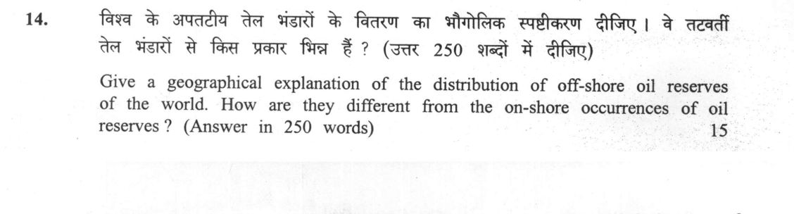
Give a geographical explanation of the distribution of off-shore oil reserves of the world. How are they different from the on-shore occurrences of oil reserves ? (Answer in 250 words) 15 marks
हिंदी में प्रश्न पढ़ें
विश्व के अपतटीय तेल भंडारों के वितरण का भौगोलिक स्पष्टीकरण दीजिए । ये तटवर्ती तेल भंडारों से किस प्रकार भिन्न हैं ? (उत्तर 250 शब्दों में दीजिए) 15 marks
Model answer
Written by UPSC Answer Check against this question's marking rubric, to the 250-word length. UPSC does not publish answers for Mains — this is one way to score well, not an official key.
Off-shore oil is concentrated where broad continental shelves and passive-margin geology preserved thick sedimentary sequences. Wide shelves of the Gulf of Mexico and North Sea accumulated deltaic, turbiditic and shelf sediments, while the Persian Gulf’s shallow shelf, though shaped by Zagros foreland tectonics, hosts prolific source rocks and traps. Rift valleys and deltaic regions also create basins: Mumbai High lies on a rifted shelf margin, and the Krishna-Godavari basin’s R-series fields formed in deltaic and shelf sediments. Tectonic setting controls accessibility more than absolute presence: stable margins allow predictable reservoirs, whereas transform faults, subduction zones and active margins can complicate trap integrity, seismic imaging and drilling, yet may still host commercial fields, as in offshore California, Sakhalin and Trinidad.
Off-shore reserves differ from onshore occurrences in geology, technology and risk. Offshore fields often occur in younger Cenozoic shelf/deltaic sequences, but major provinces also exploit Jurassic/Cretaceous reservoirs, such as North Sea, Gulf of Mexico, Persian Gulf and Brazil’s pre-salt. Onshore basins can contain older Mesozoic/Paleozoic reservoirs, though India’s Digboi and Cambay are largely Tertiary/Cenozoic. Offshore extraction needs deep-water drilling, subsea completions and higher capital, with greater spill and climate risks; however fields can be large and less disturbed by land use. For India, Mumbai High, KG basin and R-series fields show how shelf geology, deltaic sedimentation and tectonic accessibility determine offshore distribution, while onshore fields reflect different basin histories. Thus, offshore reserves strengthen energy security but demand stronger regulation, technology and environmental safeguards, especially for import-dependent India.
What "Explain" is asking you to do
Make the working of something clear — what sets it off, what follows from what, and what it produces. Explain is the Commission's mechanism word: it dominates the technical papers and the “explain why” stems, where the marks sit in the causal chain and not in the label.
Structure that answers it
State what it is → the initiating condition → the chain of cause, step by step → an instance where it plays out → what the chain produces
Where marks are lost
Describing what something looks like instead of why it works that way. Naming the stages without linking them reads as description too.
How this answer will be evaluated
Approach
Framework: Geographical Explanation & Comparative Analysis. explain: definition/context > points in order > small example > short close Full marks: Explains tectonic/sedimentary mechanism, maps key basins, and sharply contrasts onshore/offshore logistics.
Key points expected
- Mechanism: sedimentary basins & continental shelves
- Location: Gulf of Mexico, North Sea, Persian Gulf
- Difference: depth, extraction cost, environmental risk
- Link: tectonic settings to hydrocarbon traps
Evaluation rubric
Each sub-part is marked on its own, against the marks and word limit printed on the paper.
- The answer Geographical mechanism of offshore distribution and comparison with onshore reserves. 15 marks · 250 words
explain— definition/context → points in order → small example → short close
Must cover
- Mechanism: sedimentary basins & continental shelves
- Location: Gulf of Mexico, North Sea, Persian Gulf
- Difference: depth, extraction cost, environmental risk
- Link: tectonic settings to hydrocarbon traps
Loses marks
- Listing locations without explaining the 'why'
- Confusing offshore with onshore characteristics
- Ignoring the geological mechanism of formation
Earns more
- Mention of specific basins (e.g. Campos, Santos)
- Distinction between shelf and deep-water reserves
- Reference to seismic exploration methods
- Comparison of infrastructure requirements (rigs vs wells)
Extra mark
- 30-second sketch map of major offshore basins
- One robust statistic on offshore production share
Practice this exact question
Write your answer and it is marked point by point against the model answer above — what you covered, what you missed, what you got wrong.
Evaluate my answer →More from General Studies 2025 GS Paper I
- Q11 Mahatma Jotirao Phule's writings and efforts of social reforms touched issues of almost a…
- Q12 Trace India's consolidation process during early phase of independence in terms of polity…
- Q13 The French Revolution has enduring relevance to the contemporary world. Explain. (Answer…
- Q14 Give a geographical explanation of the distribution of off-shore oil reserves of the worl…
- Q15 How can Artificial Intelligence (AI) and drones be effectively used along with GIS and RS…
- Q16 Discuss how the changes in shape and sizes of continents and ocean basins of the planet t…
- Q17 Discuss the distribution and density of population in the Ganga River Basin with special…